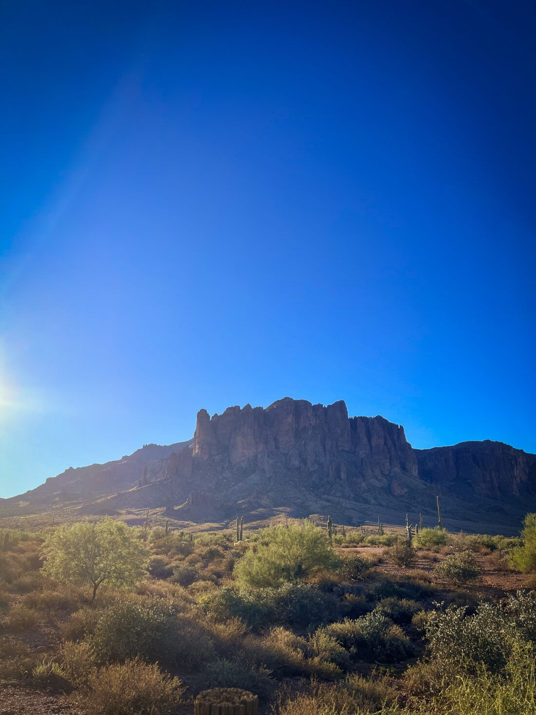
Arizona’s Lost Dutchman State Park was without sightings of ships led by SpongeBob or Jack Sparrow, but it did have spectacular views of the Superstition Mountains.
During a recent trip to a sunnier State, I took the opportunity to hike the Treasure Loop Trail, taking me one step closer to accomplishing my goal of hiking seven new trails this year.
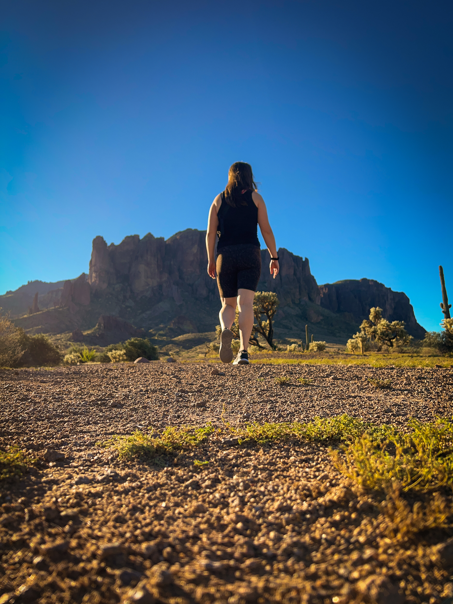
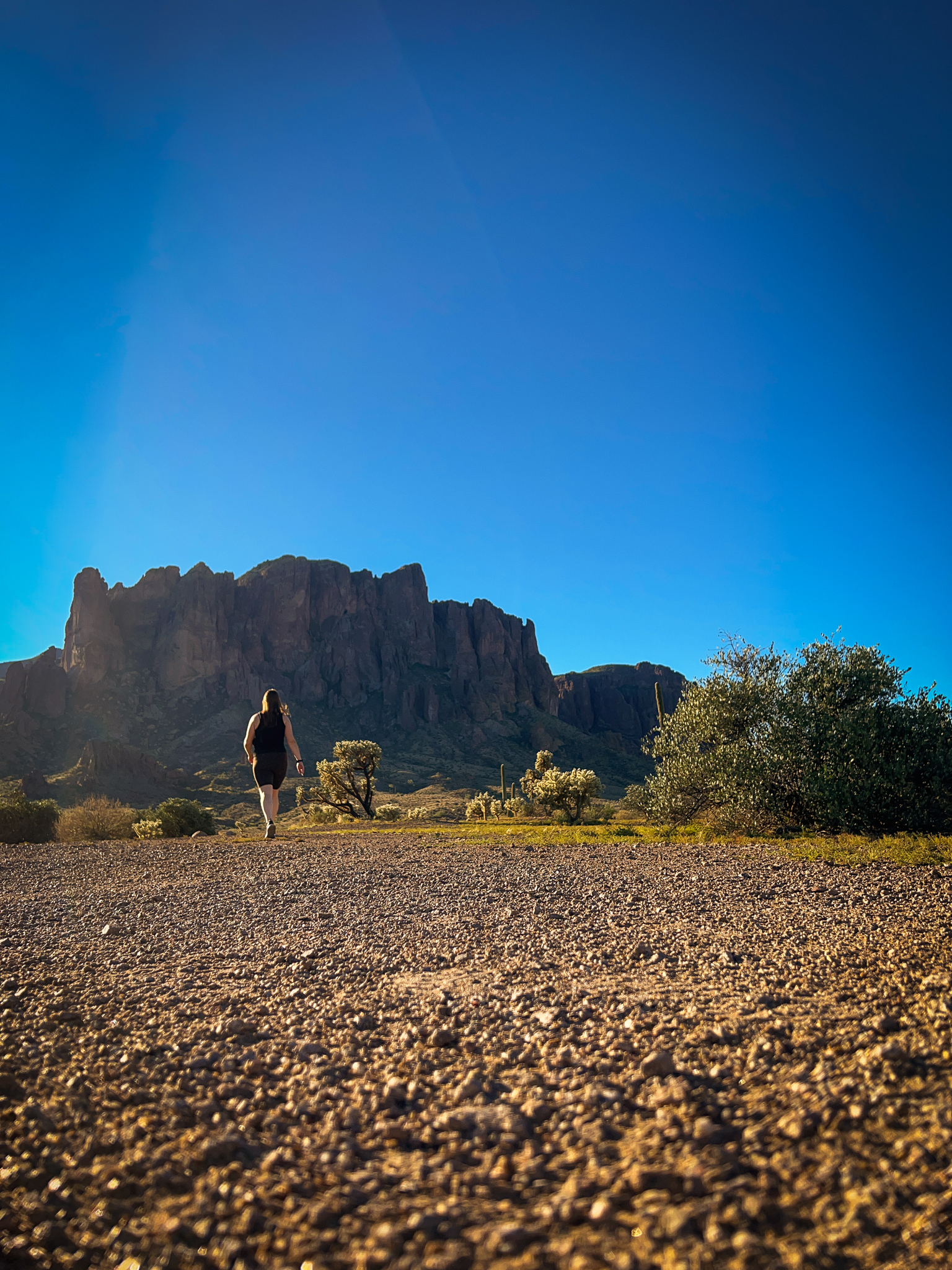
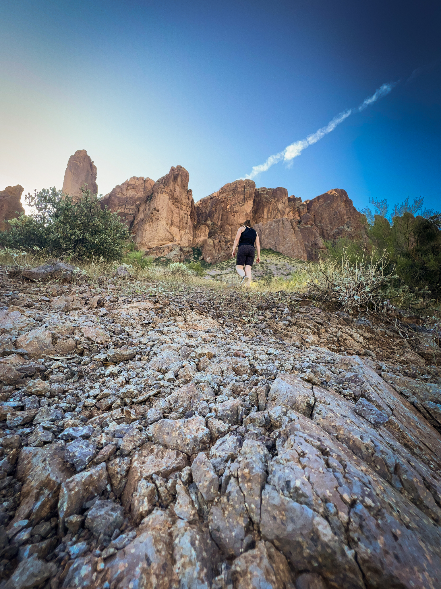
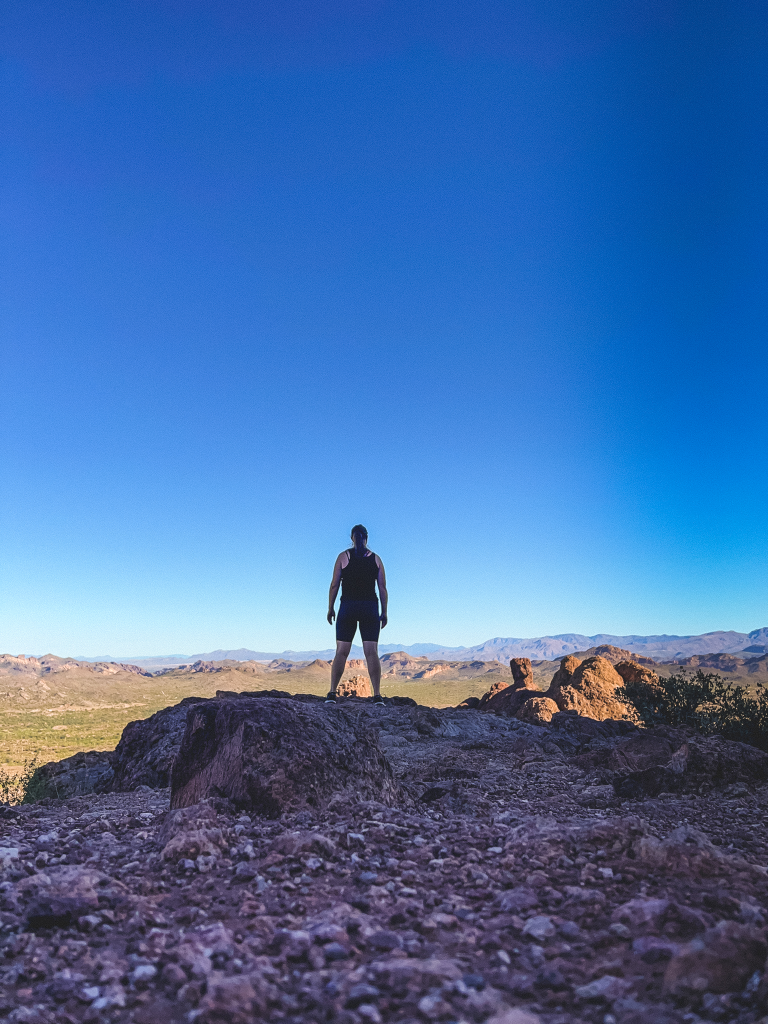
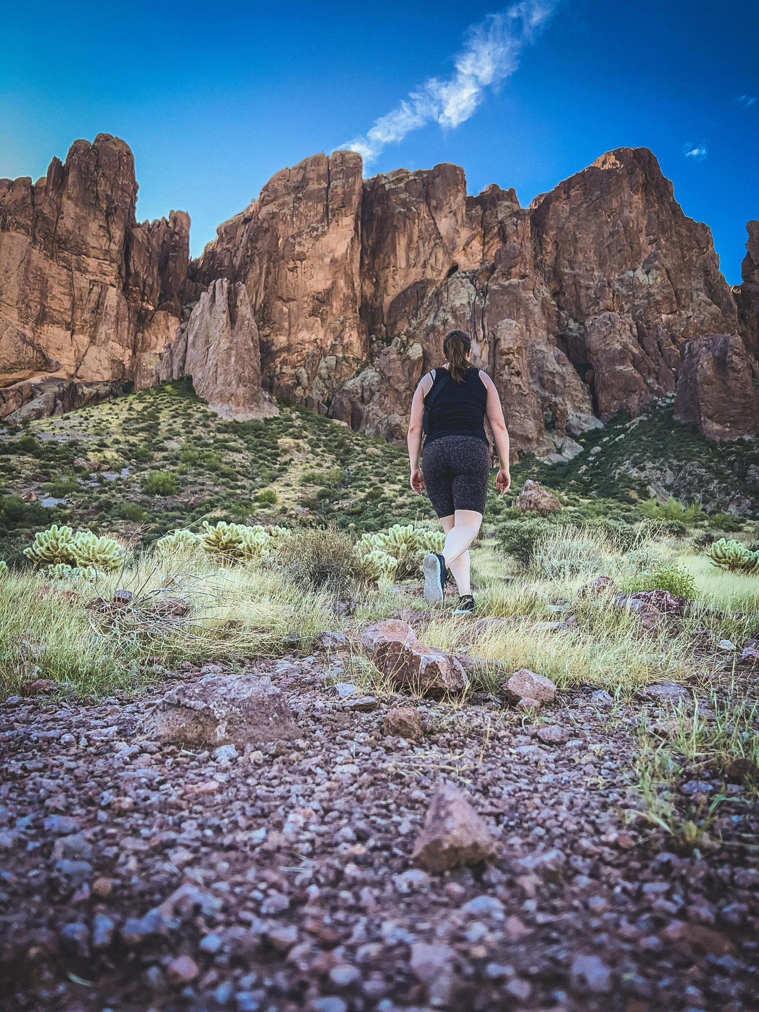
I feel like I look like I’m dramatically walking away from a burning building or a car that I’ve set on fire in this picture (let the court records show that I did not, in fact, set anything on fire in the desert).
I began my journey by immediately making a stop at their cool park entrance sign.
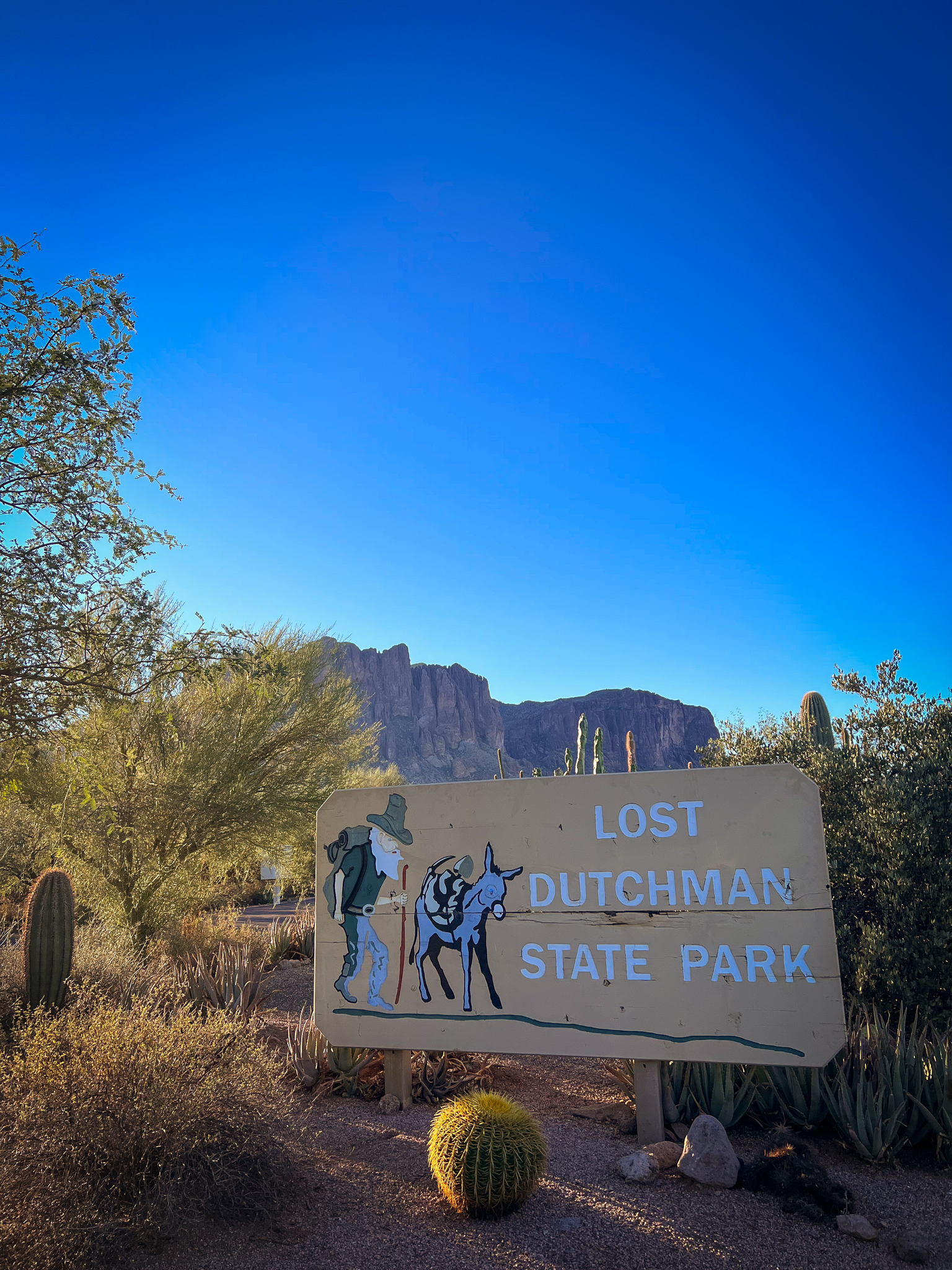
Those little paintings are cute.
The history of this park is interesting. There was allegedly once a gold mine in the area, with only a few select people knowing the exact location. In the 1870s, a man named Jacob Waltz, our infamous “Dutchman” supposedly discovered the location of the mine. According to my grandpa, and expert historian, Jacob would come from the general vicinity of the Superstitions, carrying gold with him. People tried to follow him to find the location of the mine, and he would always walk into the Superstitions, however, he would always throw his followers off. No one ever discovered the location of his mine, and it’s presumed that Jacob didn’t actually find the mine in the Superstitions, but rather walked through them to throw people off his track and keep the location a secret. When he died, he shared the location of the mine with his neighbor, but no one has been able to locate it since. Hence, the Lost Dutchman’s Mine.
I’d always admired the beauty of the Superstitions from afar, and even hiked nearby with my grandpa, but I decided to get closer during this trip.
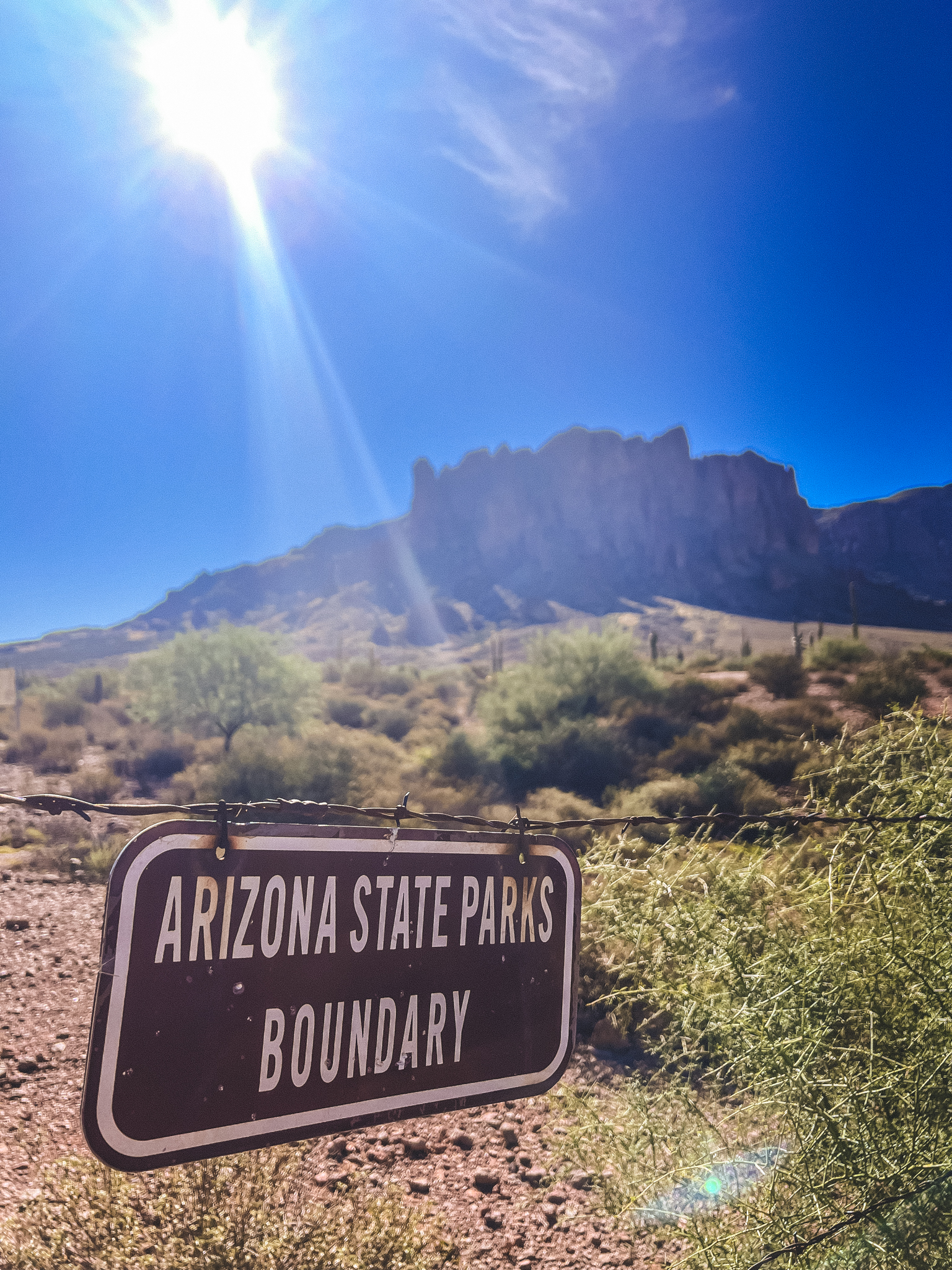
I’ve done many a hike in Arizona, so I decided to get serious about it this time and embark on a new adventure by purchasing an Arizona State Park Passport.
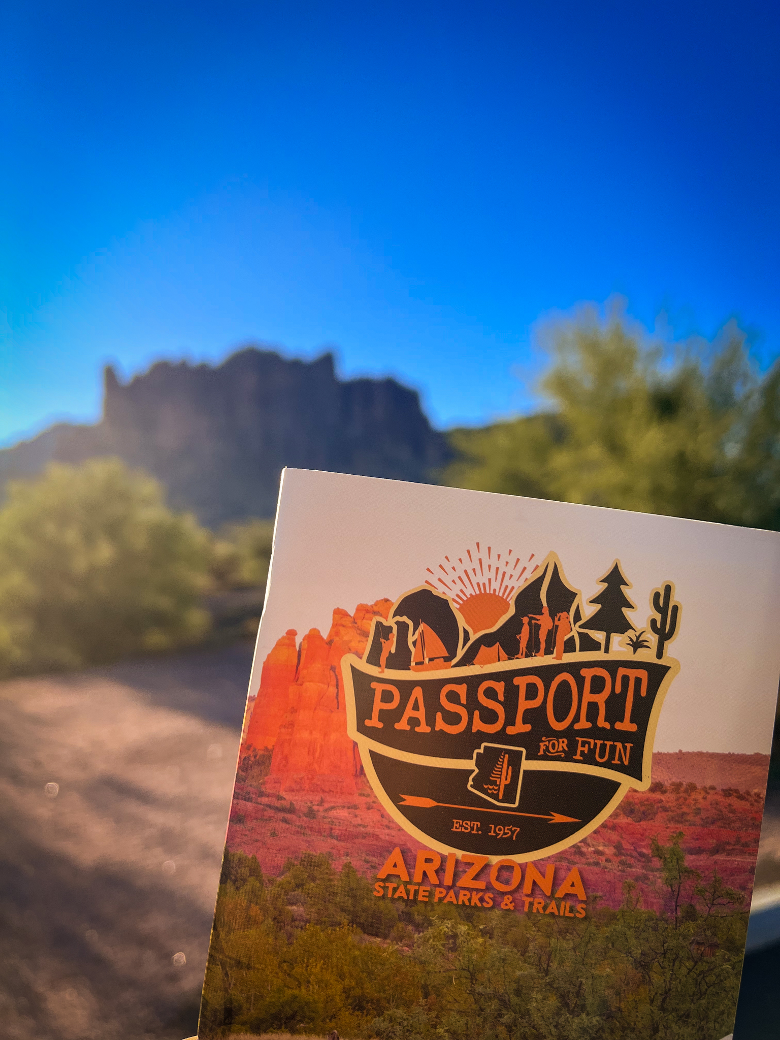
I’ve already covered Minnesota, so I might as well start on a new State, right?
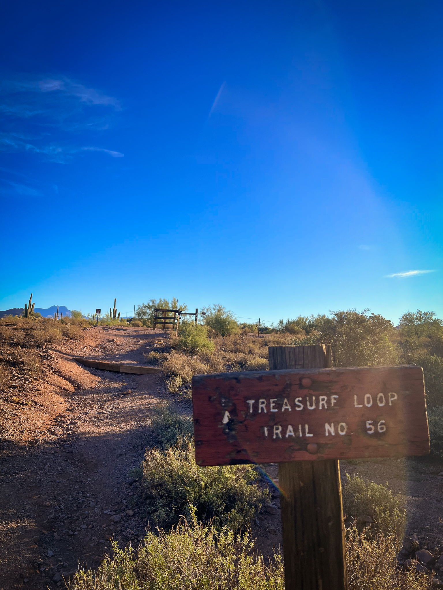
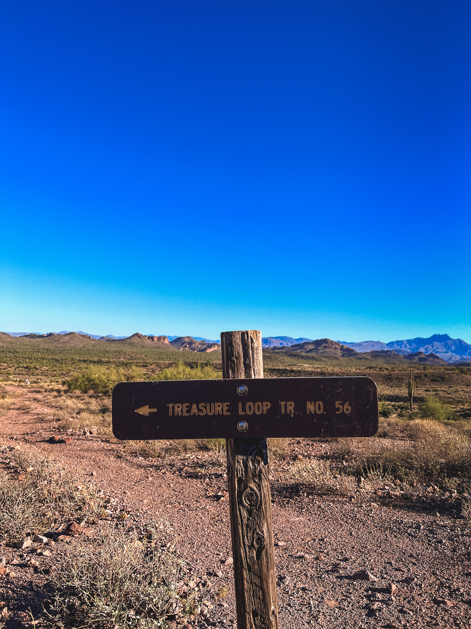
Given the park’s history, it felt appropriate to hike the Treasure Loop Trail, so off I went.
I didn’t find the park maps to be as clear as the maps we have in Minnesota, but I talked with the park rangers and they told me to park in the Cholla parking lot, so I followed their advice.
For those unfamiliar with the Cholla, it is a particularly nasty cactus with hooked spikes that are apparently a true pain to remove. I’ve stayed far away of them after hearing many stories of Cholla encounters, but they have earned the nickname “Angry Blondes” due to the color of their needles and their particularly angry nature.

They’re cool to look at though – I liked the way the sun hit the needles of this Cholla in the desert. The cactus will also drop large spikes covered in needles, so it’s typically a good idea to be cautious while near them, as stepping on the needles will be an equally unpleasant experience.
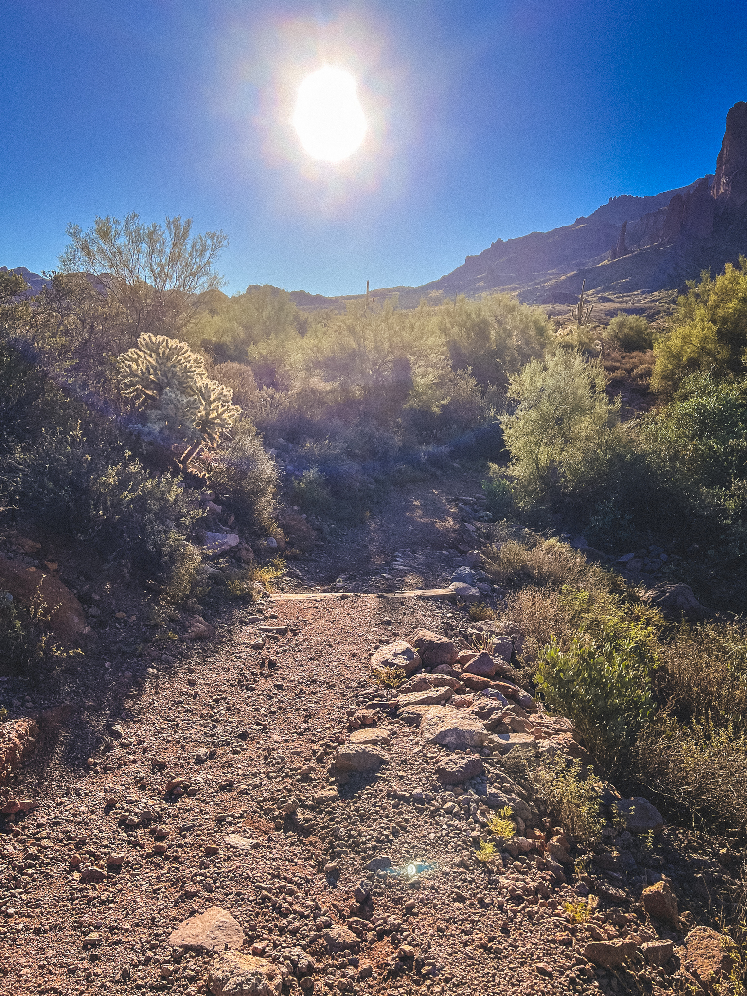
After I parked in the Cholla parking lot, I walked past a set of picnic tables into the semi-wild desert.
The trails were well-marked with these wooden signs, but I have to say that it was much more interesting following these trails than the ones I’ve seen in Minnesota. You’re walking through clearly maintained greenery in Minnesota, meanwhile in Arizona you could take a variety of paths across the dirt and rocks, if you so choose.
There were times were it was hard to distinguish where the path was, but there was the occasional wood marker to signify where the path continued. The spot above, for example, felt a bit like a free-for-all, which I didn’t mind.
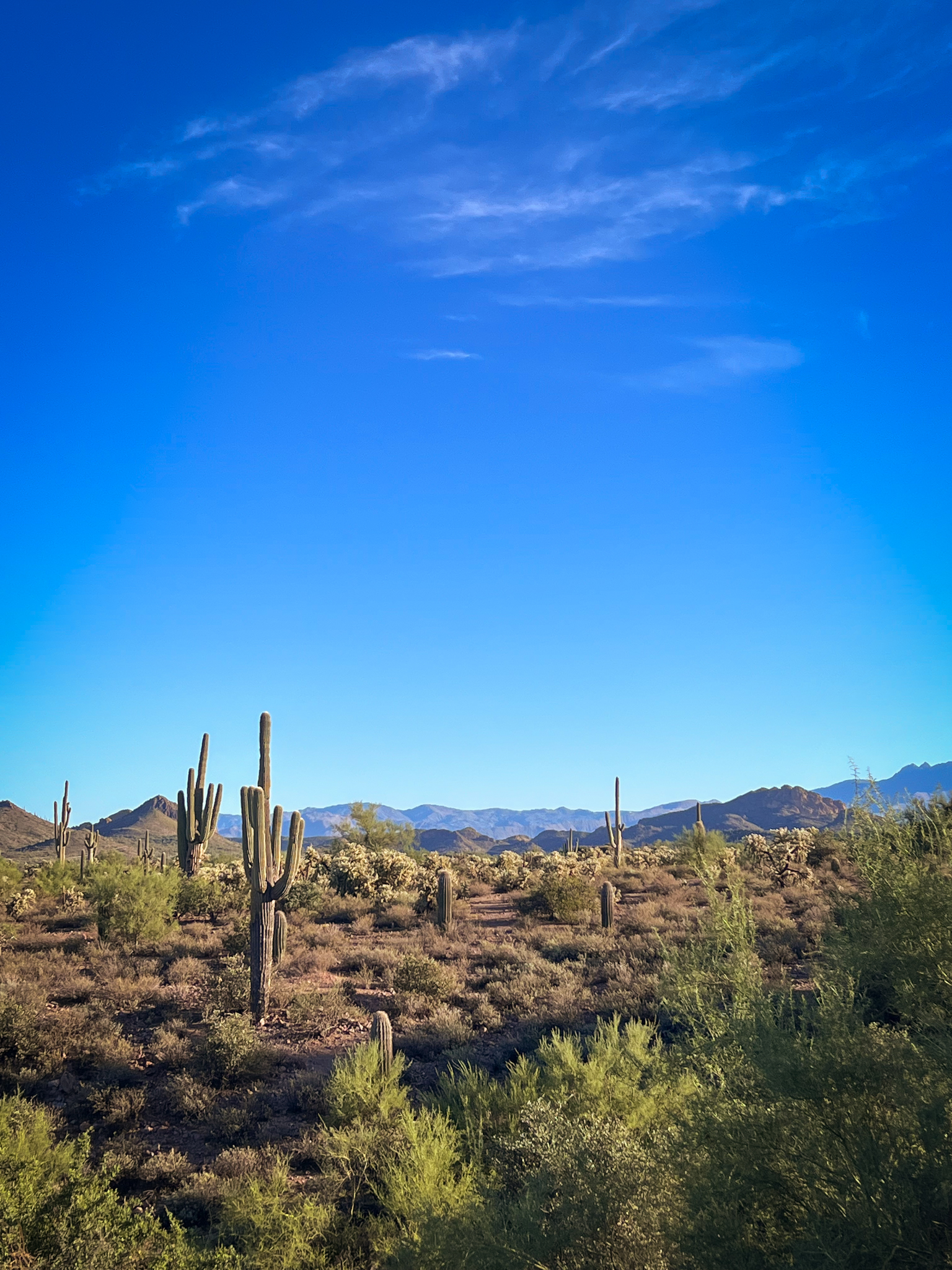
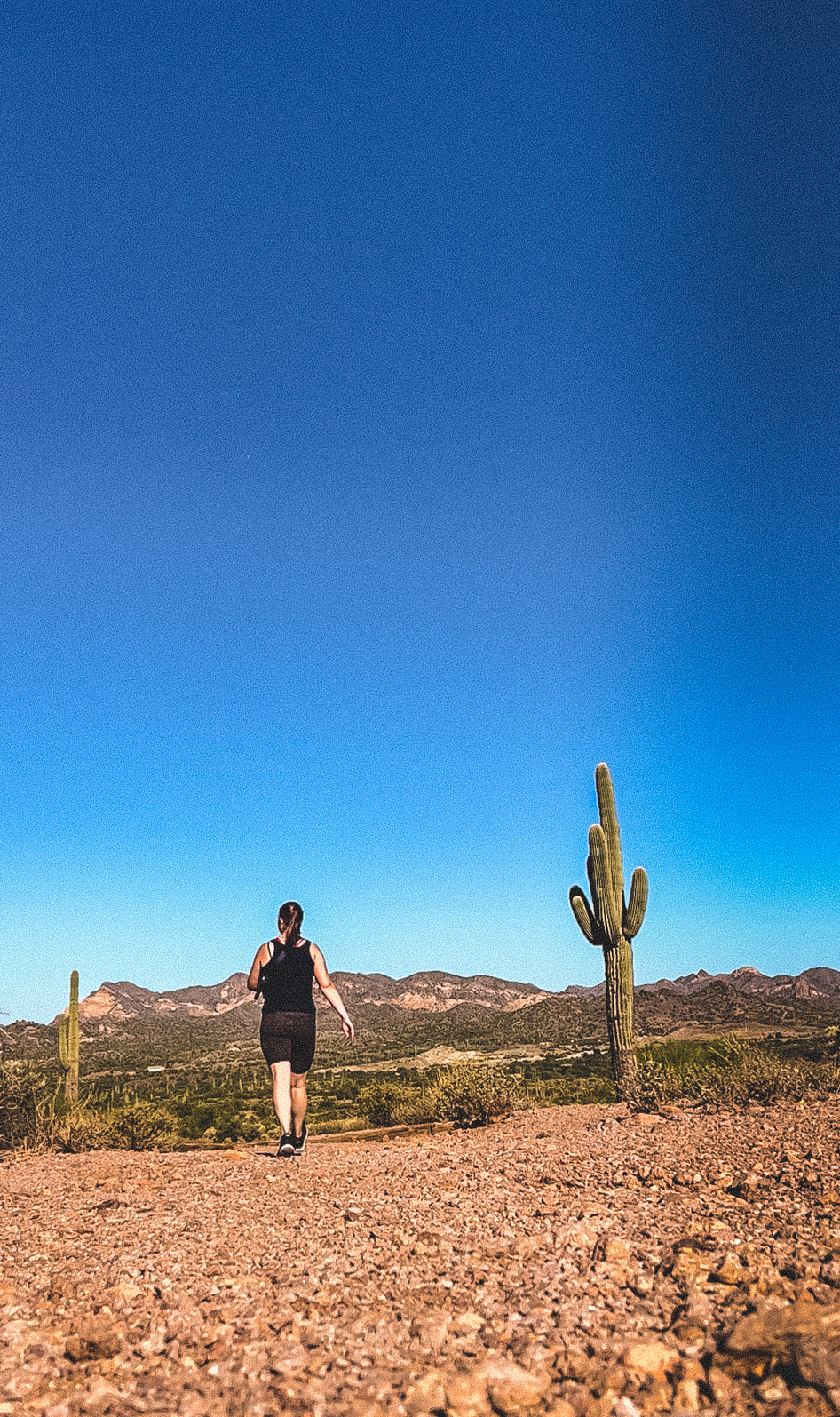
Very quickly, I felt the familiar feeling of my lungs becoming more alive – not from strain, but from excitement. The park was truly beautiful. The cactus surrounding me, and the distant purple of the mountains on the horizon were all reminders of how beautiful and different the world is.
I’d strategically left early in the morning to avoid the afternoon sun and heat in Arizona, but the sun was in a hurry to get to the center of the sky.
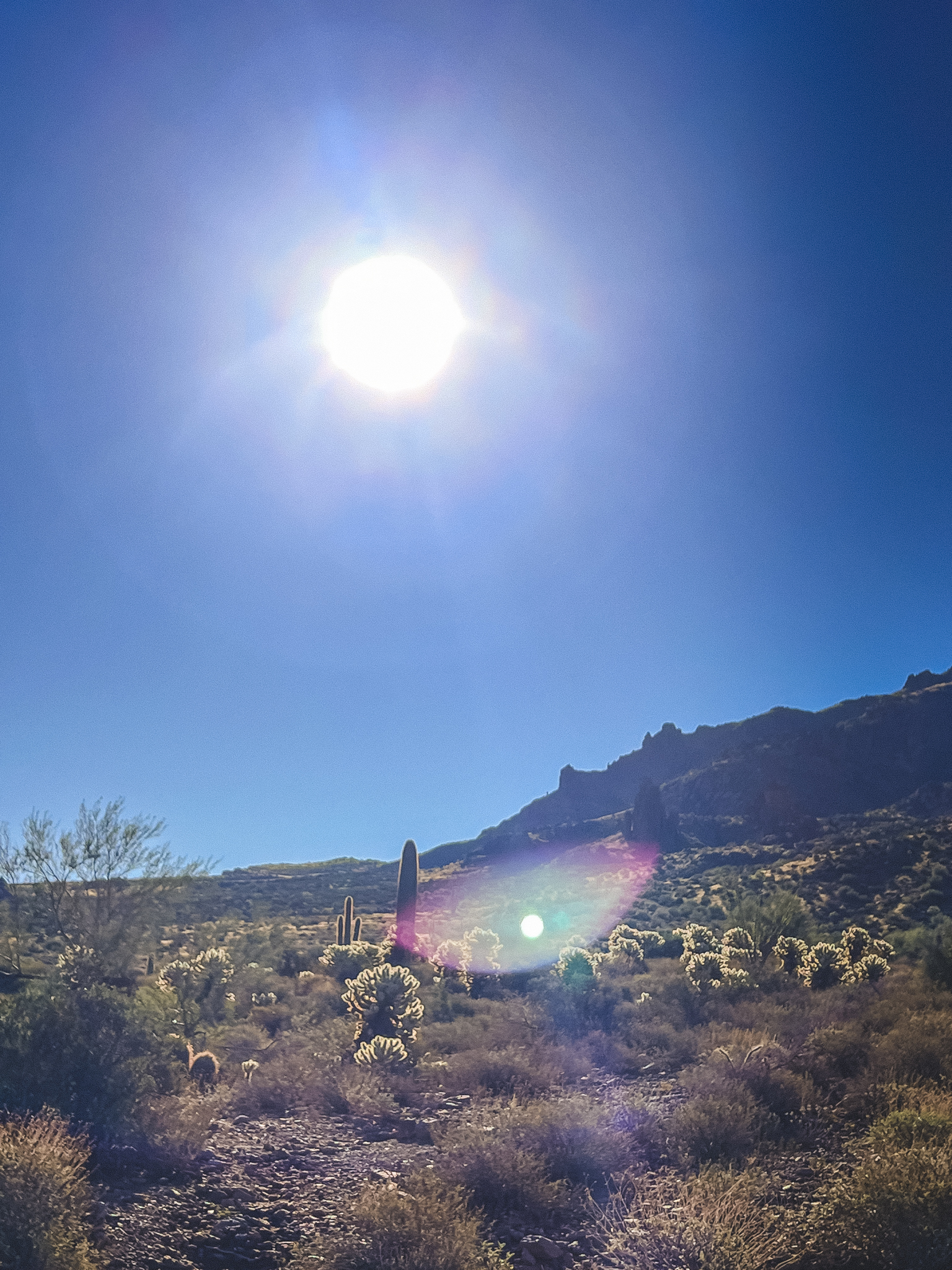
Check out all those Cholla in the distance.
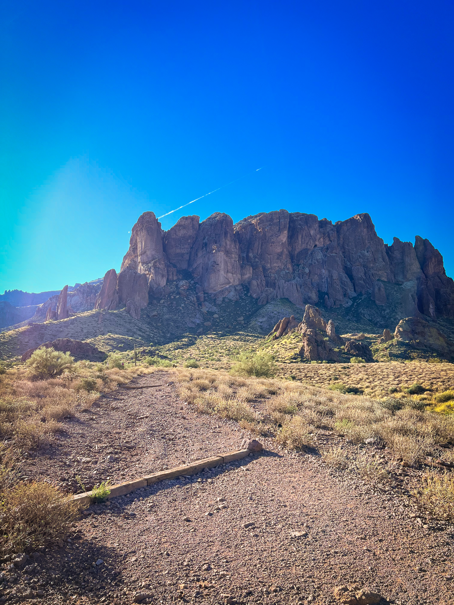
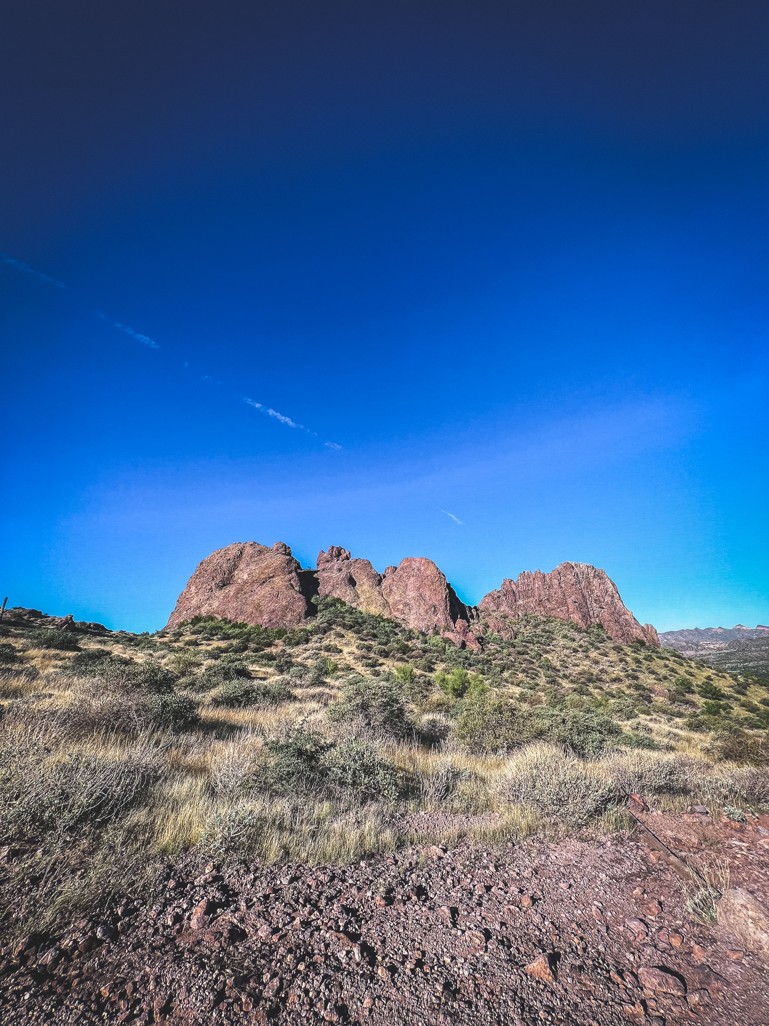
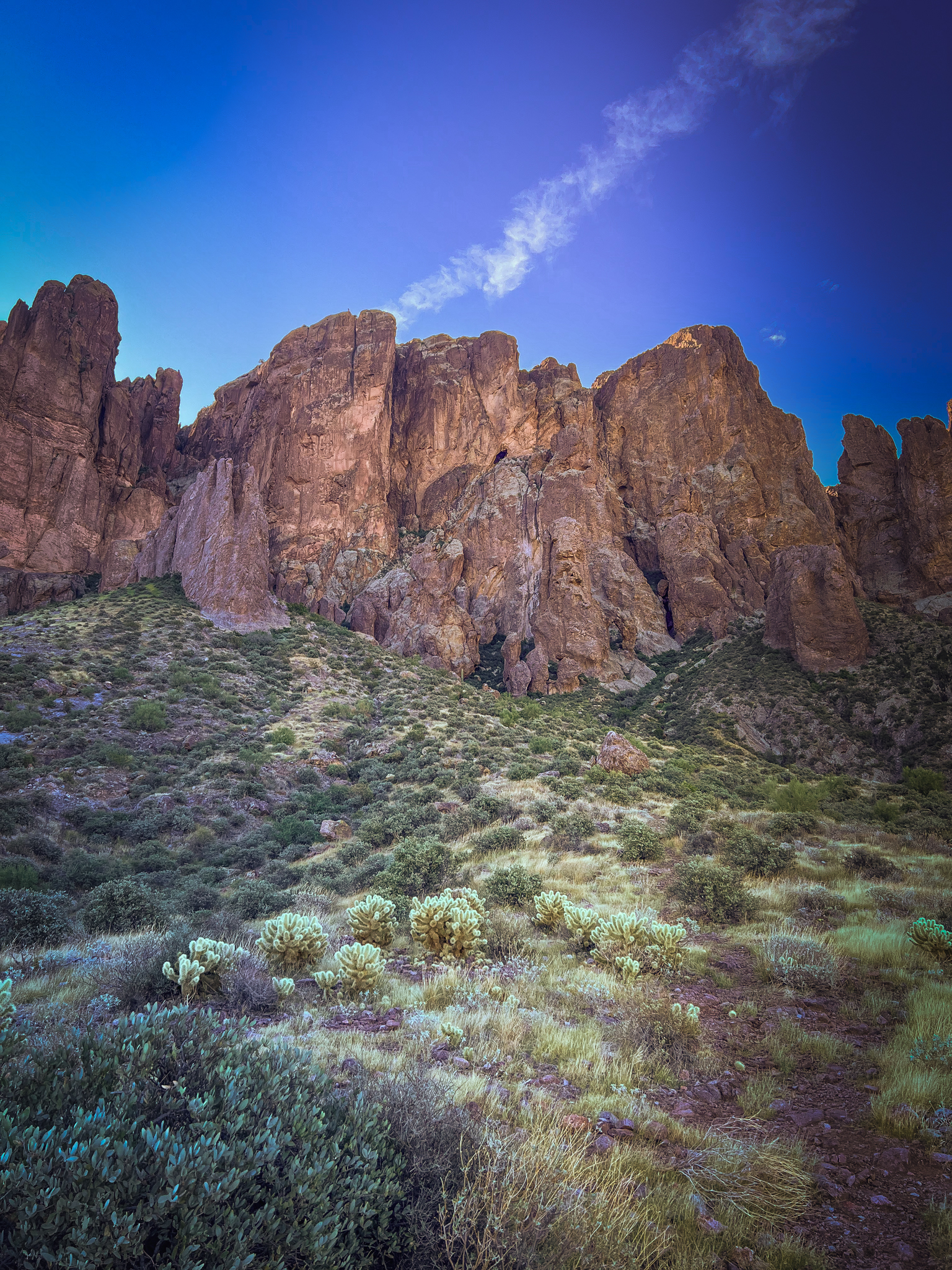
Even more beautiful than the Cholla in the distance were the Superstition Mountains.
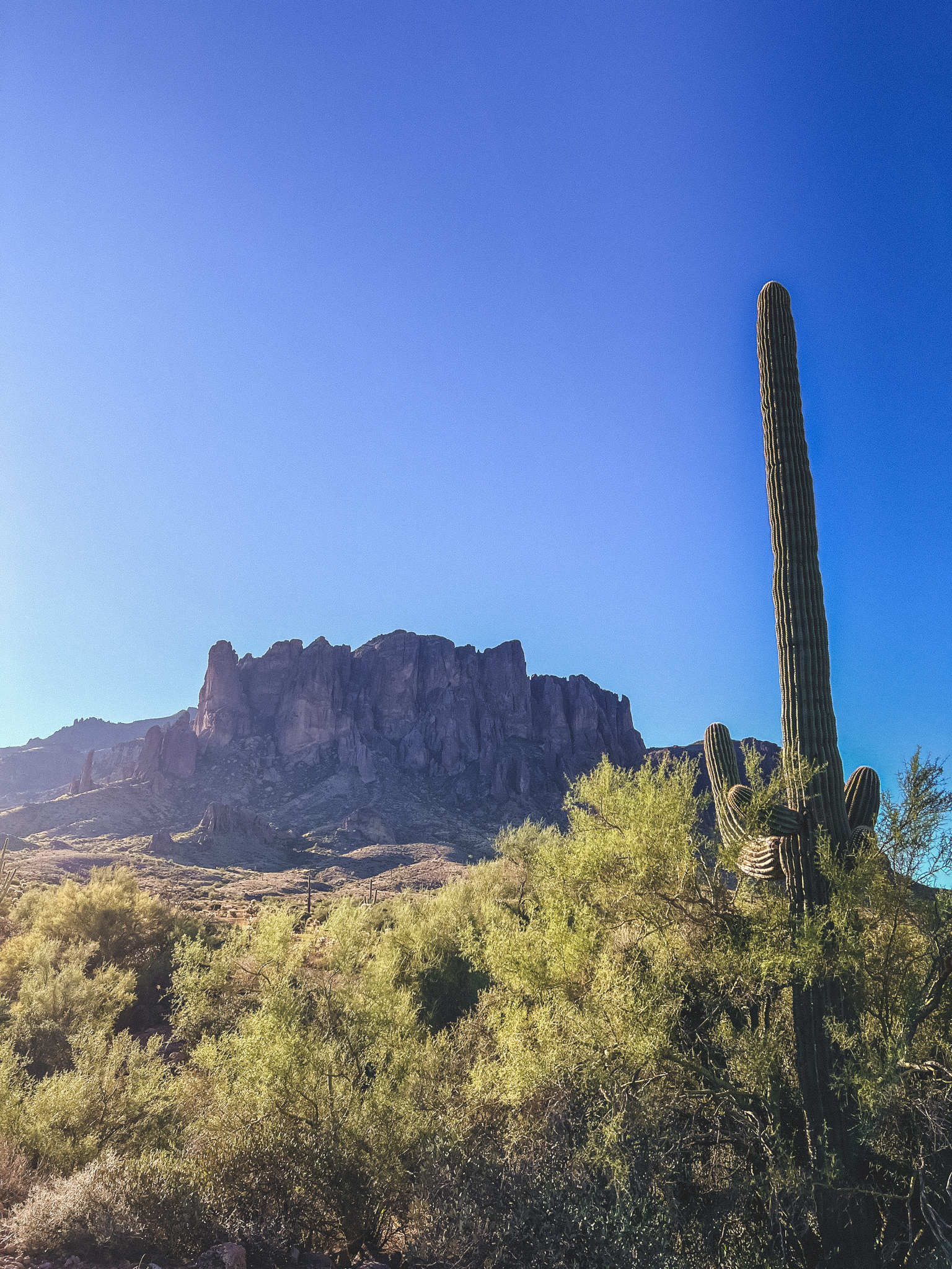
I could not get enough of them, which was good, because they were not only the largest feature on the horizon, but also my destination.
While I was walking, I heard the sounds of dogs barking in the distance, which made me a bit nervous, because there are coyotes at this park, and I did not want to mess with them. There are also bobcats at the park, which I also hoped to avoid.
Most of the park had clear visibility without a lot of places to hide, but there were the occasional sections that dipped down into batches of cactus and other desert plants, in which I felt a little more cautious, as it felt like a good hiding space for a creature.
I comforted myself by reminding myself that if I was being stalked by a wildcat I probably wouldn’t know it until it was too late, so I might as well enjoy the hike without worrying too much about it.
Plus the rare foliage was pretty cool to look at.
I didn’t end up seeing any coyotes or bobcats, but I did see one desert hare and a few roadrunners.
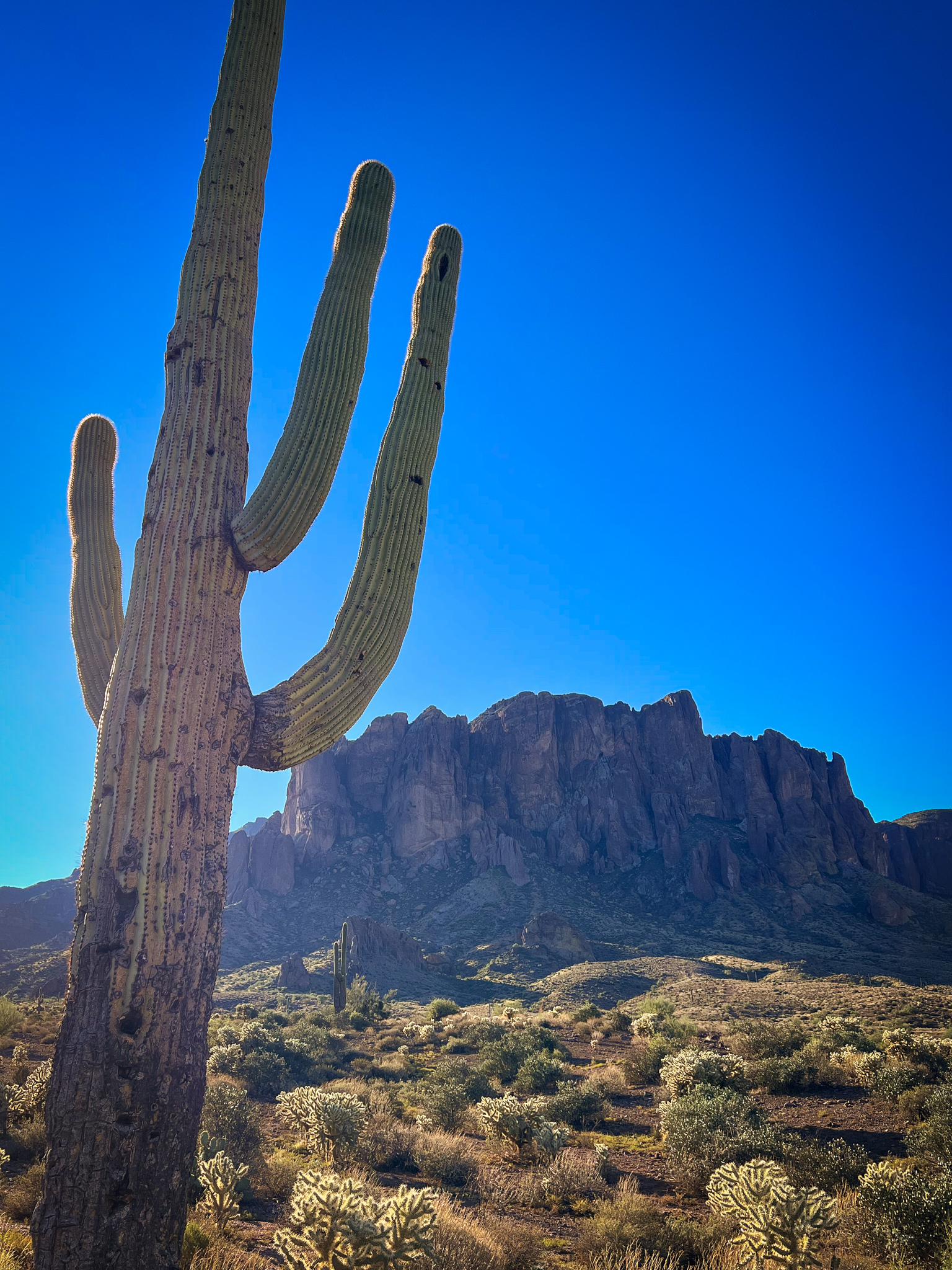
I could not resist being a huge nerd and taking this photo when I found the perfect Saguaro cactus.
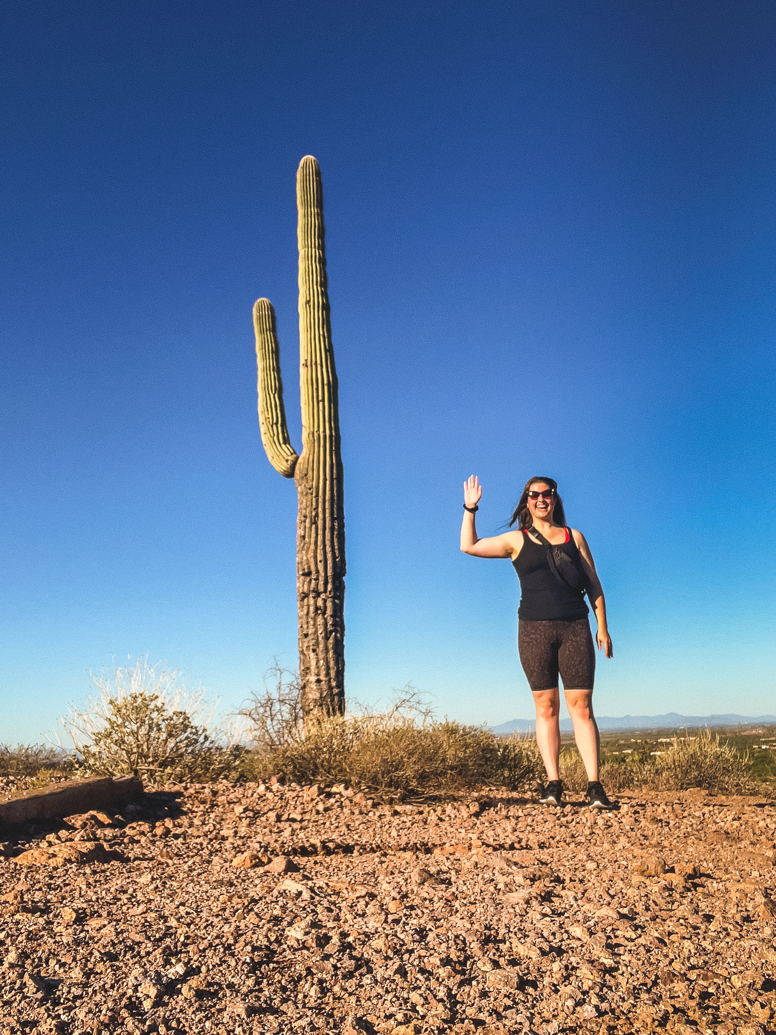
I always say that my futures kids are going to hate me and my sense of humor, and I stand by that statement.
And so does this Saguaro.
I continued following the path, appreciating the wooden markers every now and then.
I imagine they serve some other purpose at the park, but I enjoyed the confirmation that I was headed in the right direction.
I also enjoyed the aesthetic (and function) of the signage.
Maybe it’s just the mountains in the distance that make it look so cool? Maybe it’s the wooden stake? Maybe it’s the fact that it’s slightly uneven?
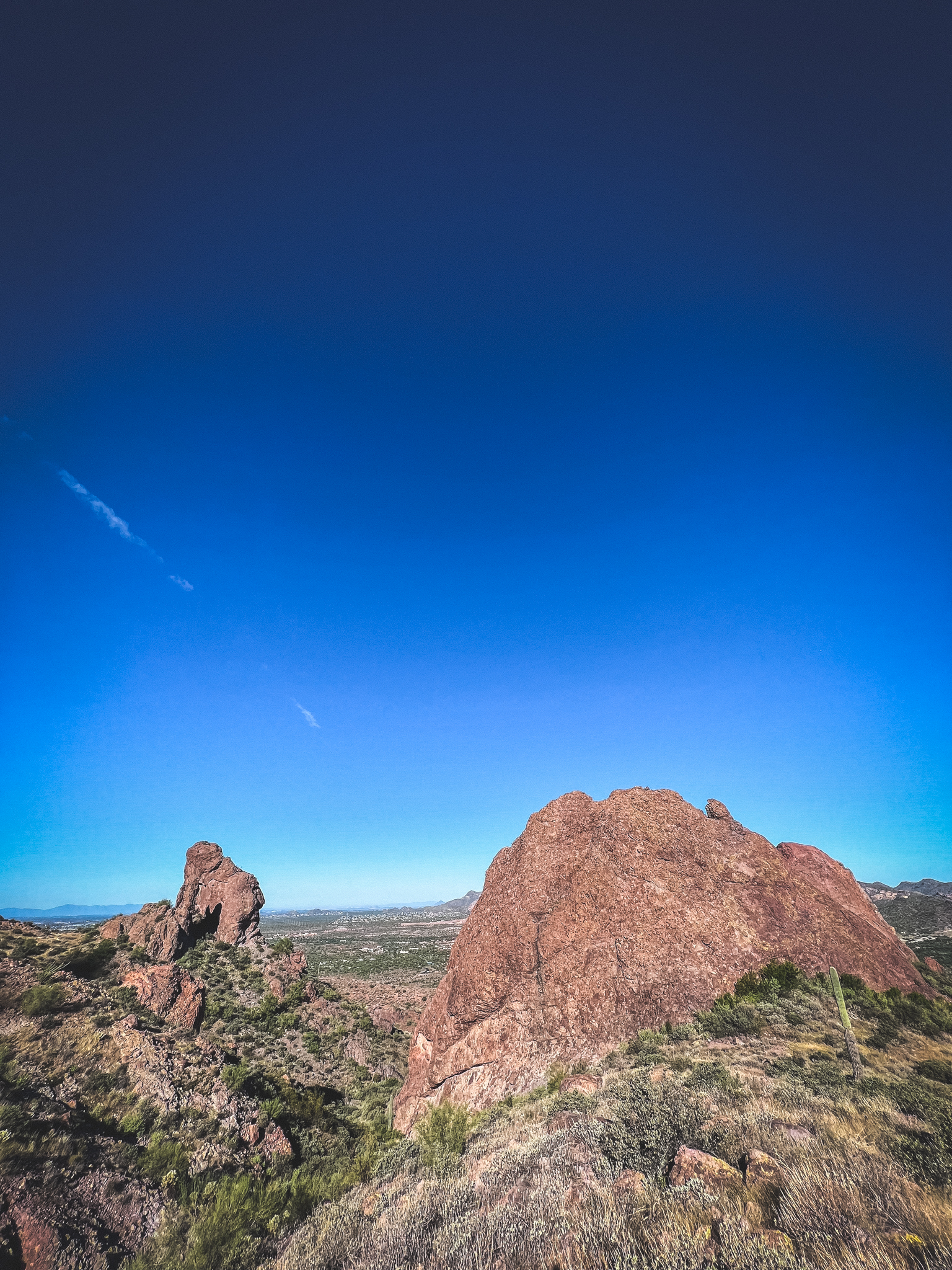
I began to get giddier (and more out of breath) as I got closer to the Superstitions.
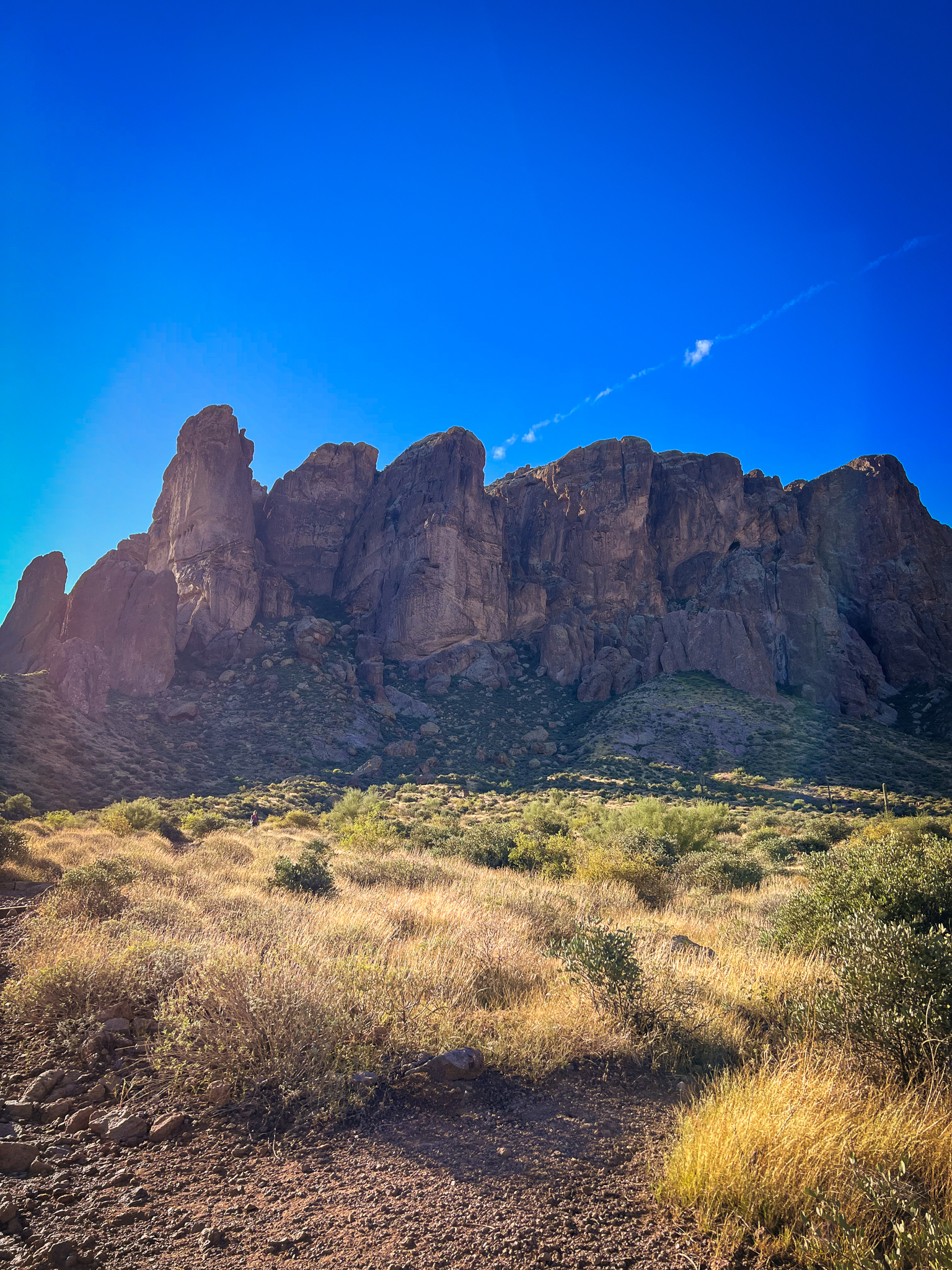
They were so cool up close!
After this point, the trail began more of an incline in the Arizona sun, and I was glad I brought a giant bottle of water with me.
To my right was a super neat outcropping of rock that I thought looked like a pregnant woman laying down with her hands folded above her baby bump.
She has a very clearly defined bob haircut, eyes, and nose, in my opinion.
After climbing the incline and coming around the bend, I got another pretty cool view of the same rock formation, this time from the “head” of the woman.
That’s right, Arizona. Do your thing.
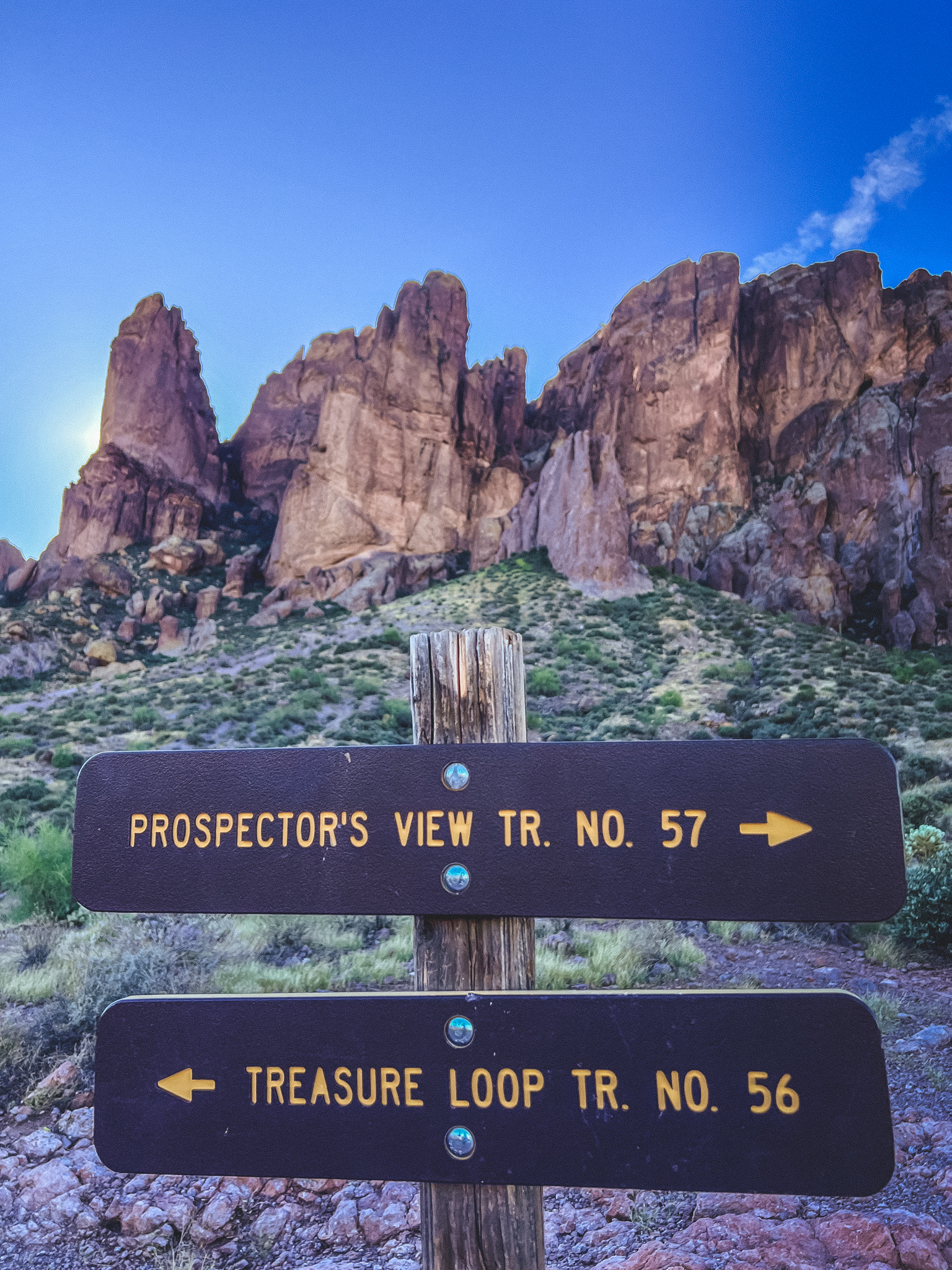
Okay, we have to stop for another cool sign.
There was no other way to go, so this one didn’t really serve a purpose, but come on! It’s so weathered and cool. I feel like I’m going to discover a very neatly marked trove of treasure.
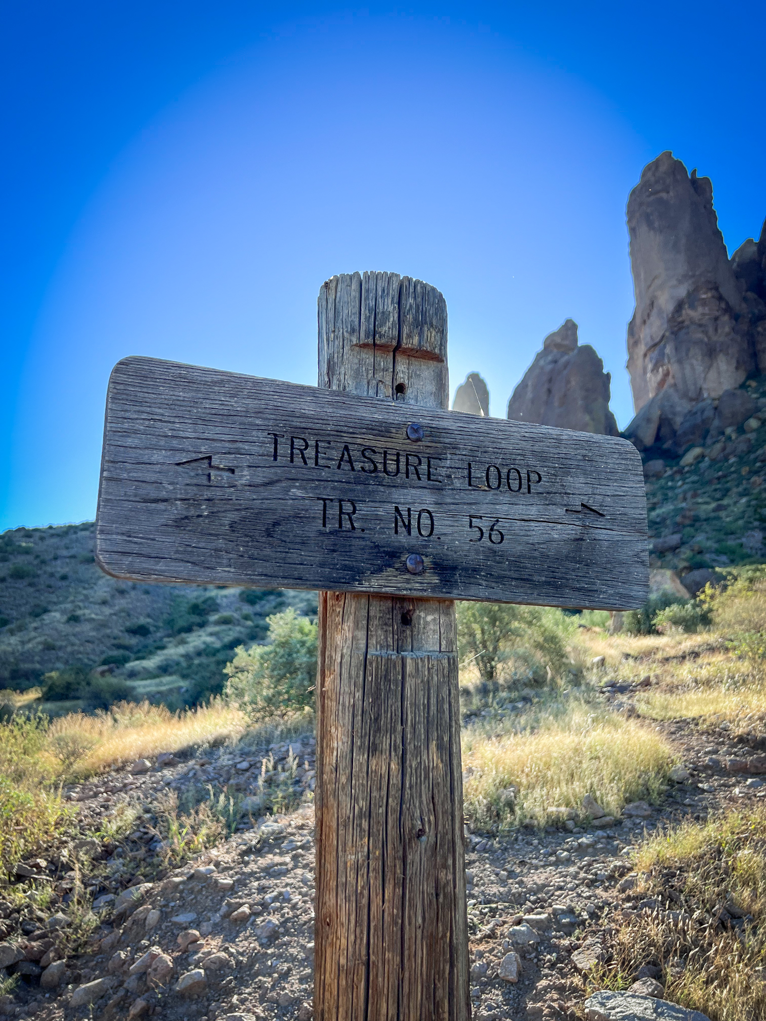
The sign even says “Treasure Loop.”
Ok, I did blow past the signs a little bit because I was curious. I wanted to get a little closer to the mountains, and it was really cool.
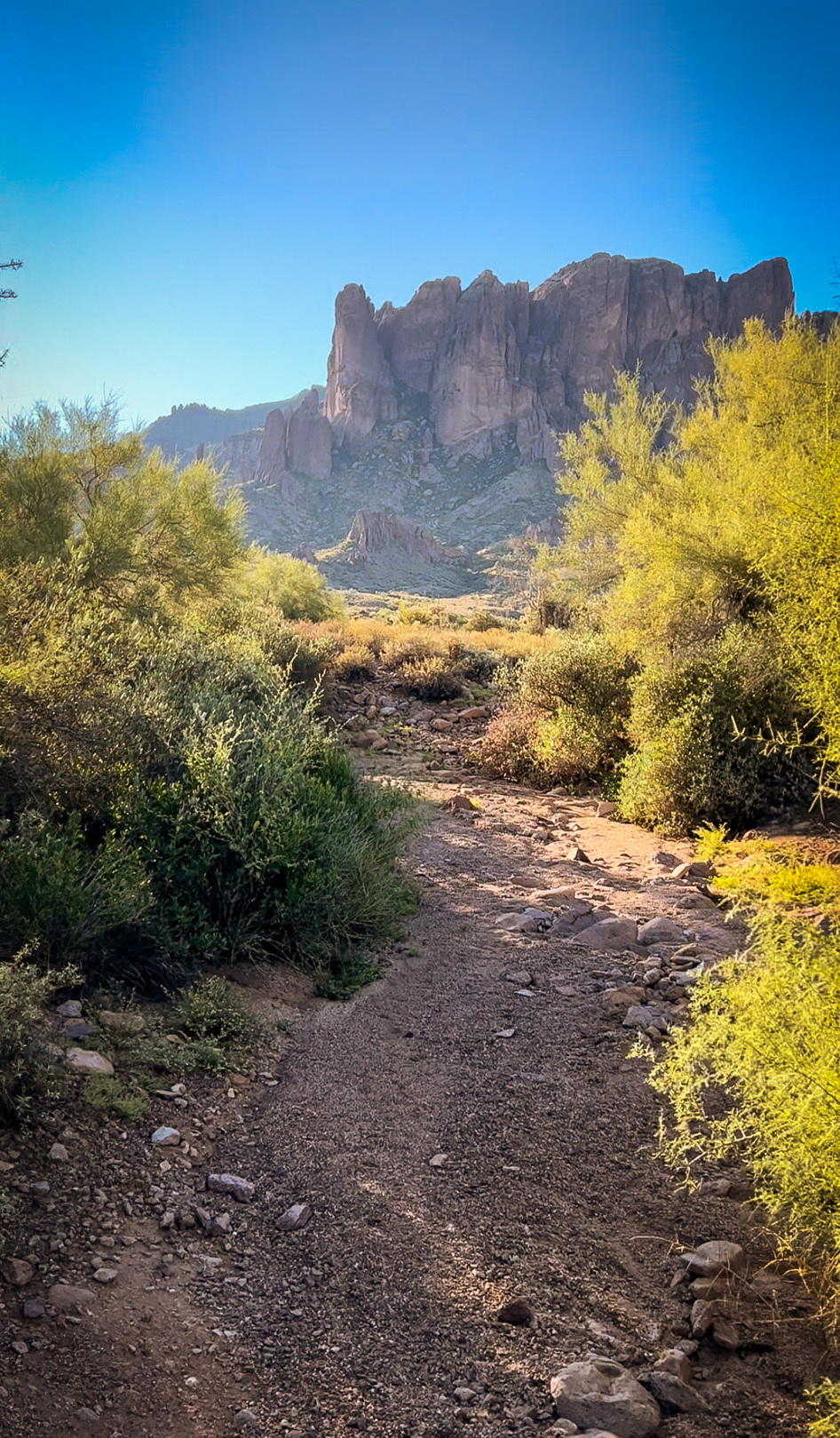
This next section of the path moved away from the dirt trails and more toward a rocky route that ribboned just underneath the Superstitions.
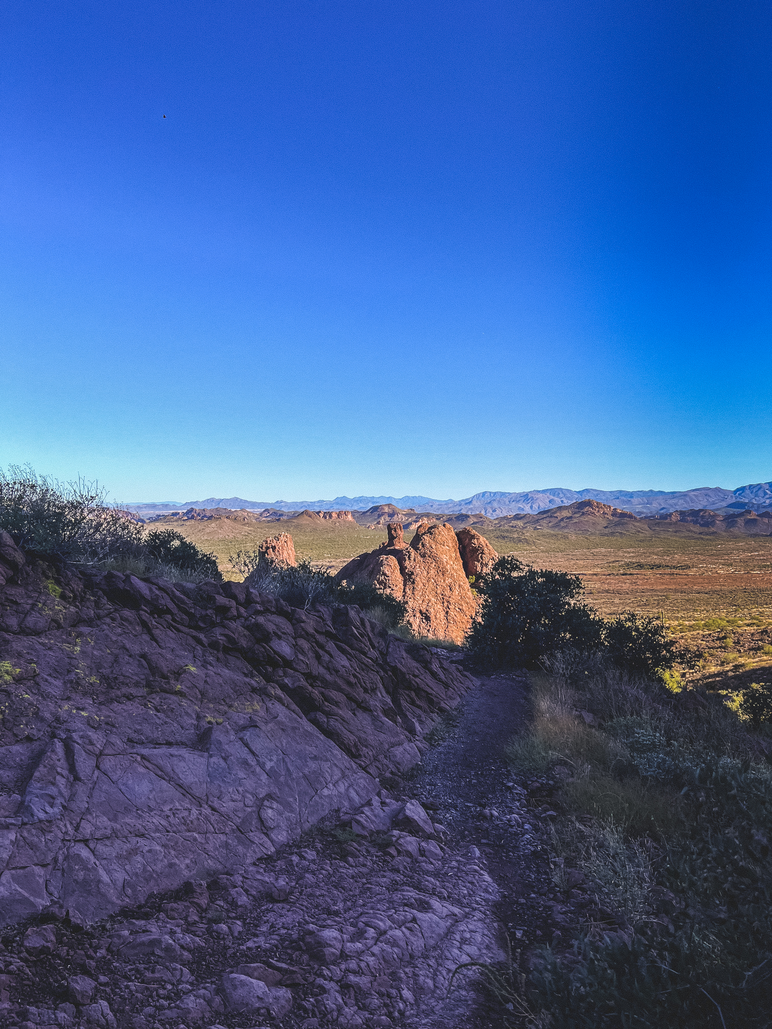
Because of its location underneath the mountains, it was also doused in shade, which felt really nice.
Eventually, the path rounded out to a larger open space with a bench and beautiful views of the mountains.
And here is where I made a mistake: I listened to other people.
I was catching my breath, taking in the views, and contemplating breaking into a celebratory protein bar when I heard a group who’d been hiking in front of me talking. They sounded confused, and when I turned around, they were examining their map, and talking about how they weren’t sure where they should go.
I was standing right in front of the signage, but it didn’t indicate exactly where we should go.
The Treasure Loop Trail is just that – a loop. You shouldn’t have to worry too much about getting lost, as you’re following a simple loop. However, this sign seemed to point back down the same trail we’d just come up for the Treasure Loop, and meanwhile, the only other visible trail was the Prospector’s View Trail.
I took a look at my map, and it showed a small hook below our current location. Sure enough, where the map showed, there was a set of wooden stairs that descended beneath a rock outcropping. I pointed it out to the group, and showed them how it matched the map. They started walking down the stairs, and as they did so, I took the opportunity to enjoy the rocky overlook.
However, the group shortly came back up, and told me there was nothing down the stairs. They said they were going to take the other trail, which I did not want to do, as it was several miles longer, and I was running short on time that morning.
I took a quick look down the stairs, but ultimately assumed it must take you to another overlook, and not the rest of the trail. I was wrong.
I decided to head back the way I’d came instead of getting lost in the desert.
When I got closer to the pregnant-woman-rock-outcropping, I realized there was another trailhead there, and it matched up with the other section of the loop. I’m pretty sure if I would have trusted my map and my gut and gone down the set of stairs, it would have taken me back to the main section of the path, and I would have completed the full loop.
Either way, I was able to experience an insanely gorgeous hike in Arizona, and one more brand new trail.
I also met a new friend.
As the morning turned into afternoon, more and more of these little lizards were scurrying around. My grandpa always used to say that they “do pushups” when they’re scared or trying to intimidate you, as they do a sort of pushup motion with their arms.
It wasn’t too long before I was back to the start of the trail, satisfied with my hike.
I could not recommend this hike more – I can’t wait to return to this park during my next trip to Mesa, Arizona, and look forward to adding even more stamps to my passport.
Until then, there will be plenty of adventures in-between!
Let’s Connect: