I’ve finally done it.
I’ve found the perfect Minnesota trail.
After many moons and 75 State Parks, I’ve finally found my favorite Minnesota trail(s). Here’s a little glimpse of what we’re working with.
It’s giving National Treasure. It’s giving Indiana Jones. It’s giving Lord of the Rings. It’s giving all of the vibes, energies, and landscapes I’m always looking for in a hike.
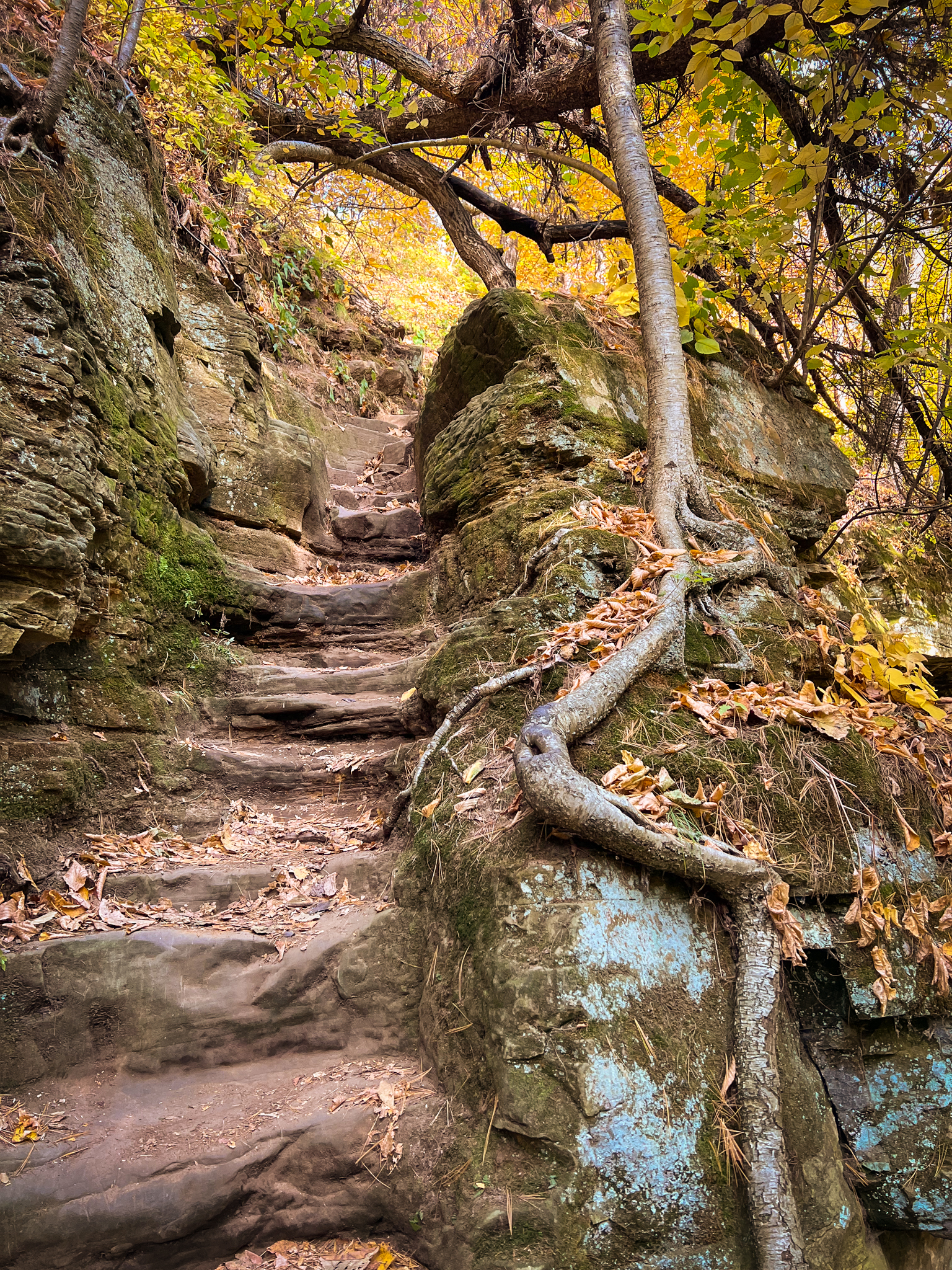
What you’re looking at is a set of semi-sketchy stairs clinging to the side of a bluff at the top of a very steep hill, all resting beneath a canopy of red, green, and yellow trees gently changing colors in the cooling Minnesota weather.
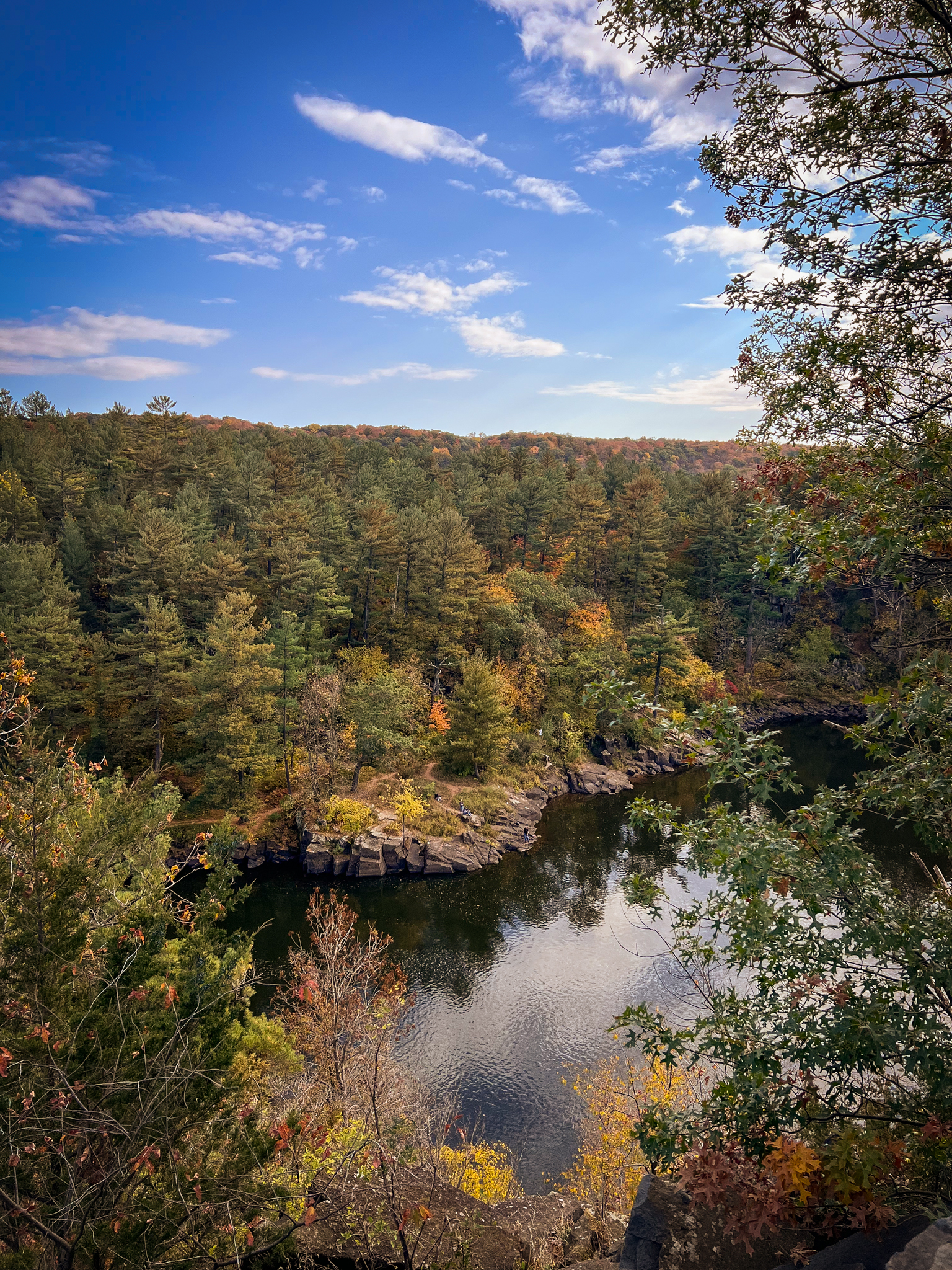
So where is this awesome trail located? Naturally, one of my favorite State Parks, Interstate State Park. What a mouthful. I’ve loved this park for several years due to its insanely beautiful views of the river, set between rocky bluffs and pine trees, as well as its interesting geology. The park is riddled with glacial potholes, some large enough to climb into, which is very cool.
In fact, because Interstate has remained locked in at my top tier favorite State Parks, I was pretty shocked to find this new trail, because I didn’t think the park could get any better.
But it did.
First things first, when you get to Interstate State Park, you’re going to completely forget about the insanely busy regular park entrance located in town. It’s always crowded and a lot of times it’s impossible to find parking, and it’s a complete waste of your time to try to park there. What you’re going to do is drive down to the campground entrance instead – there is a very large lot there with plenty of parking, even on the busiest of days, and it’s less annoying to get in and out of. Trust me.
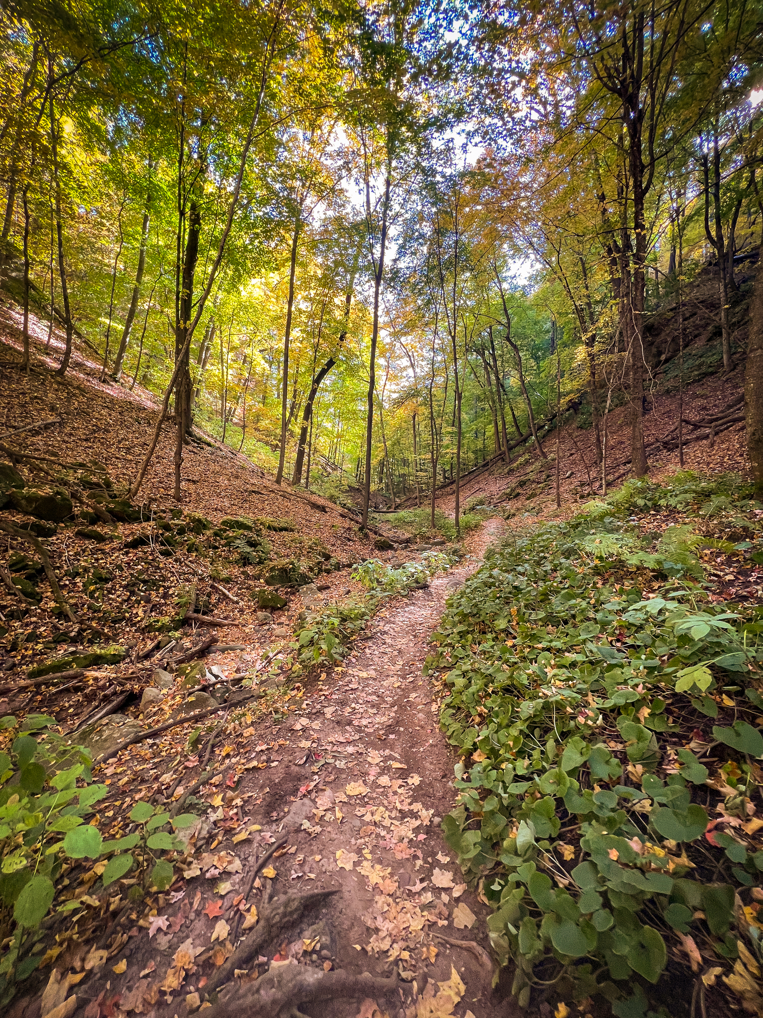
It’s also closest to the Sandstone Bluffs Trail, which is the apple of today’s metaphorical eye.
I’m a big fan of collecting a map prior to my hikes (or at least taking a photo of the map), so I would recommend heading to the park ranger’s station at this side of the park prior to your hike. You’ll have to walk right up to the ranger’s station anyway, so you might as well.
To the immediate left of the ranger’s station is a sign that will point you to the direction of the Sandstone Bluffs Trail, and just beyond it is a super cool tunnel that will take you under the highway.
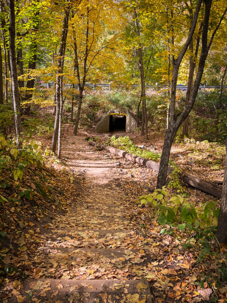
We love a good tunnel.
Once you stroll underneath the highway, you’ll be faced with two options: Sandstone Bluffs Trail or Railroad Trail.
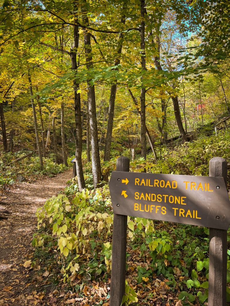
You’ll pick the Sandstone Bluffs Trail because it’s the coolest, and because Railroad Trail will have its time in the sun soon enough.
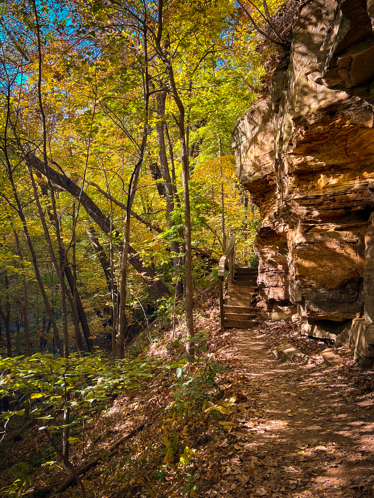
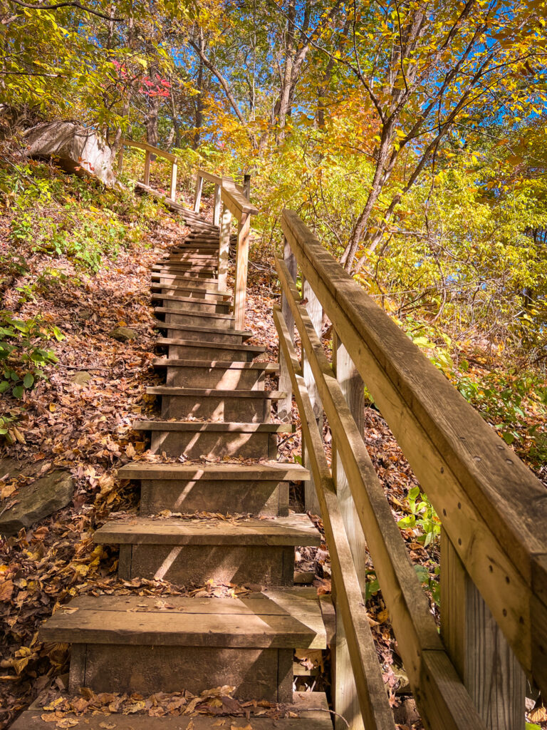
After a few feet, you’ll reach a set of stairs with an enormous number of steps.
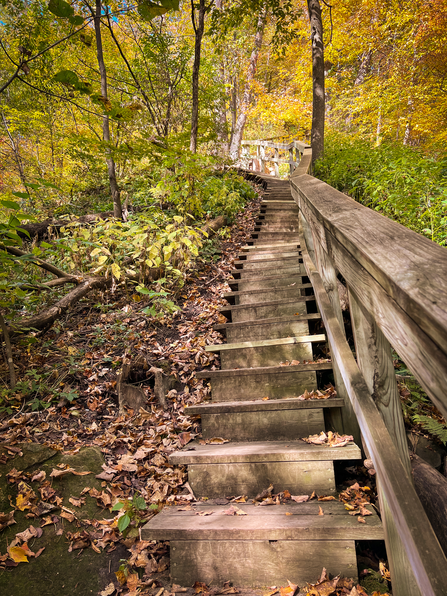
You’ll ignore the fact that the bottom set of stairs are sitting at a bizarre angle and will use the railing to keep yourself steady as you climb the precarious stairs and tell yourself that they’ll even out as you get closer to the top, and what do you know, they will!
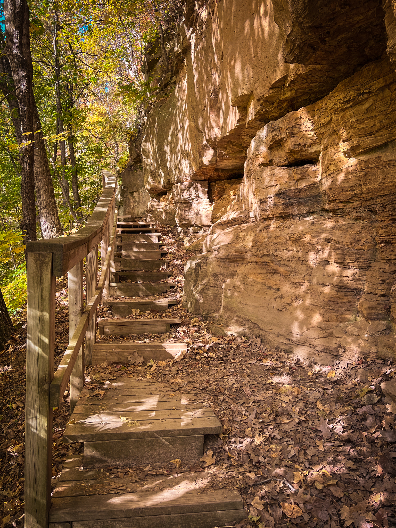
Once you climb to the top of the stairs, you’ll walk a little ways along the side of the bluff before you reach more stairs!
You’ll go up some stairs, and suddenly you’ll go down some stairs!
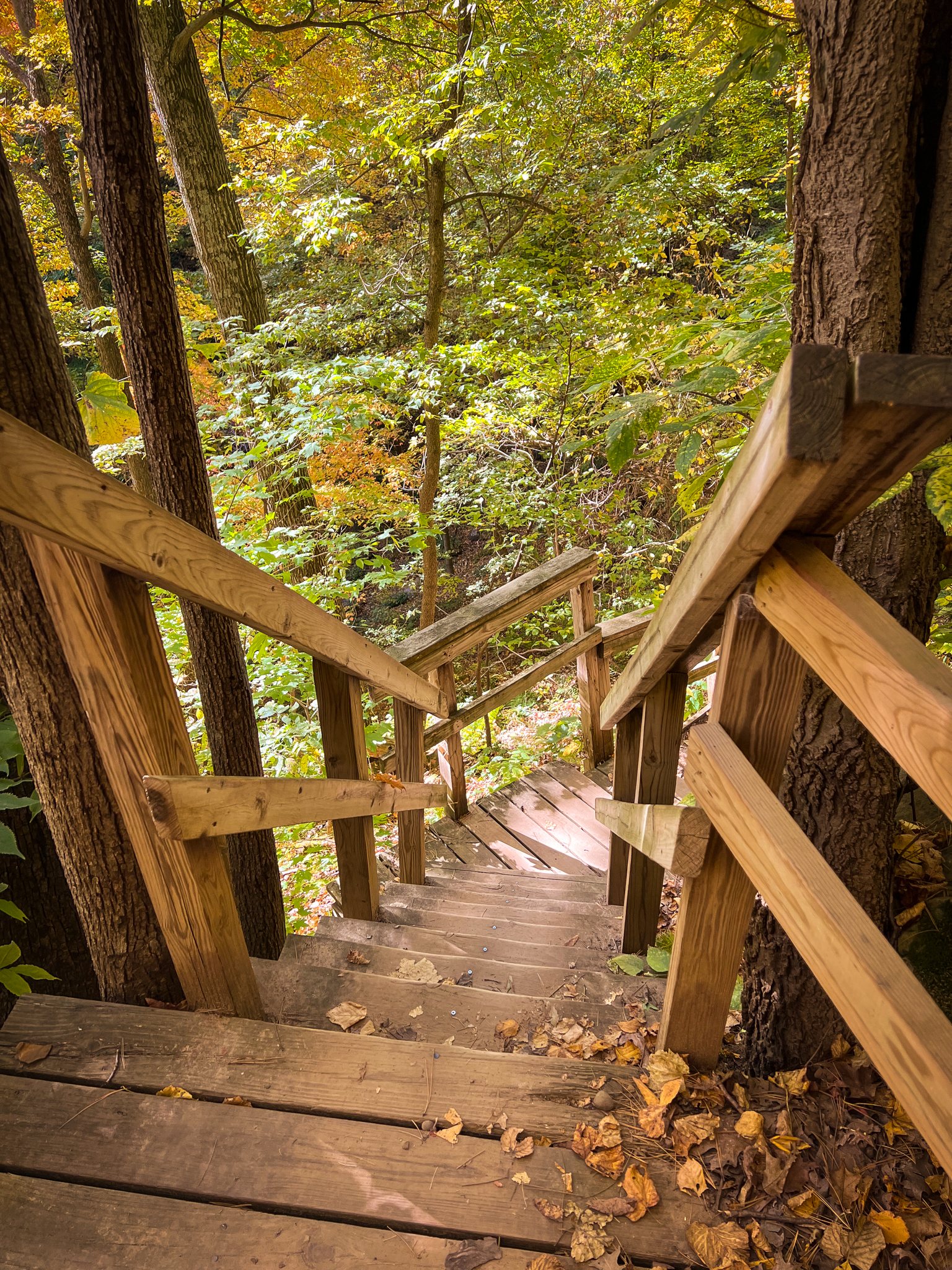
Very steep, indeed.
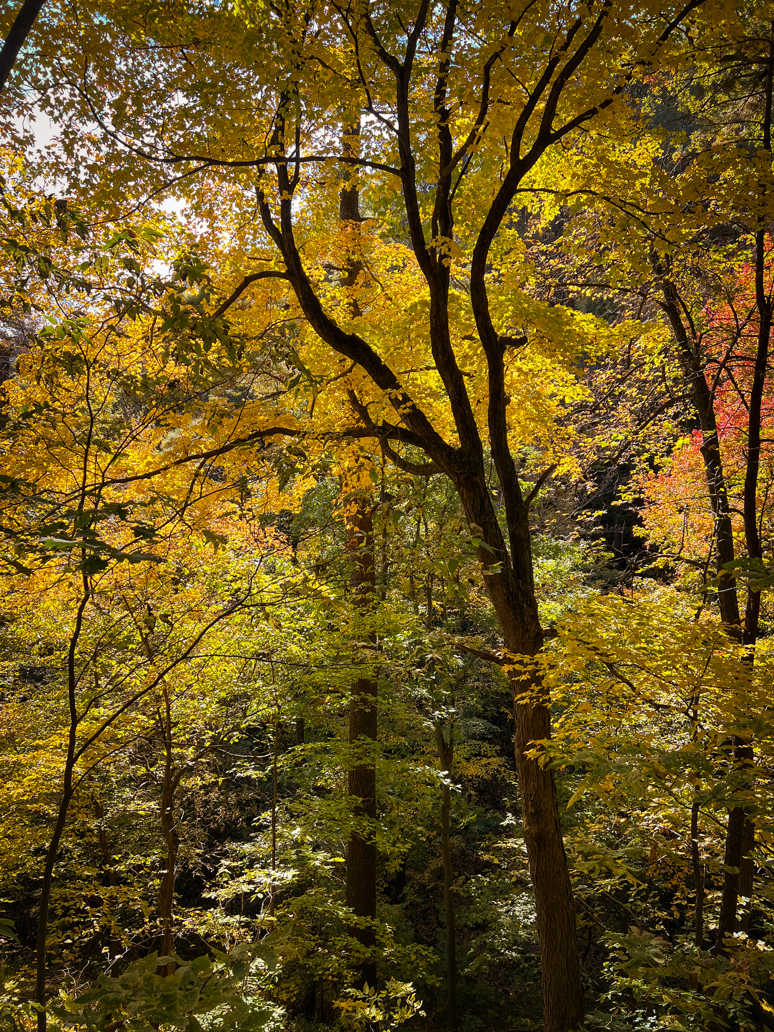
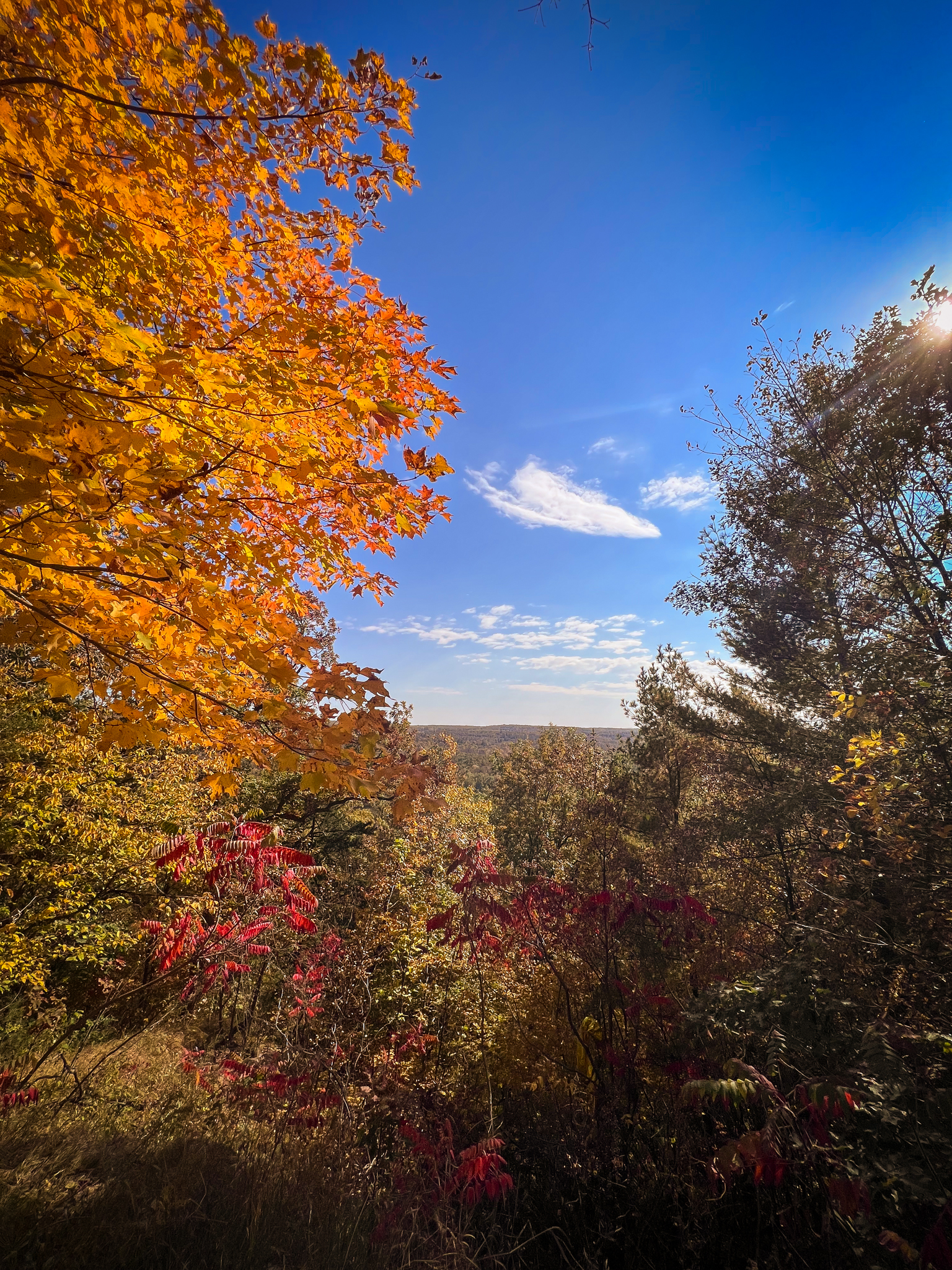
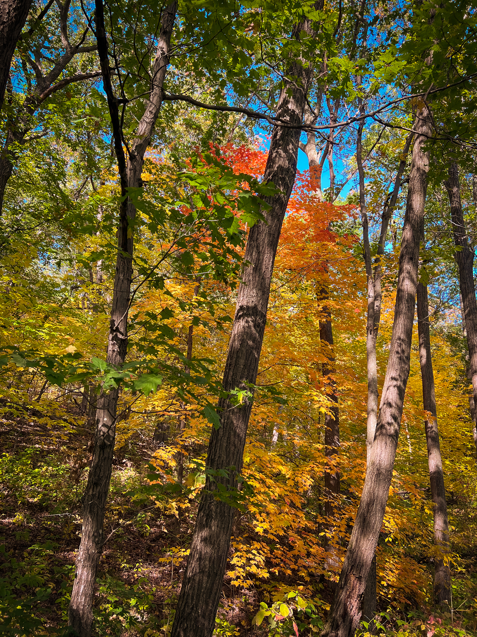
But, being this high up, you have the pleasure of taking in the multitude of changing fall colors among the treetops.
And come on, the stairs make the hike. They might not all be the sturdiest, but they are a super fun element unique in comparison to any other park staircases in Minnesota.
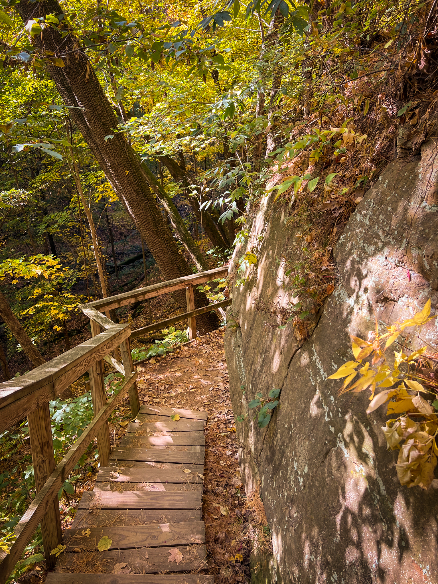
The thing that distinguishes these stairs from the first set is that you’re walking directly along the side of the bluff. While you’re higher up and closer to the cool features of the bluffs, the path is incredibly small and at most points, near very steep drop offs, which I found to be very exciting and which enhanced my experience of the hike! It felt like a real adventure. I only wish the trail was longer – in all, it’s about one mile.
Tell me these stairs aren’t cool and I’ll call you a liar.
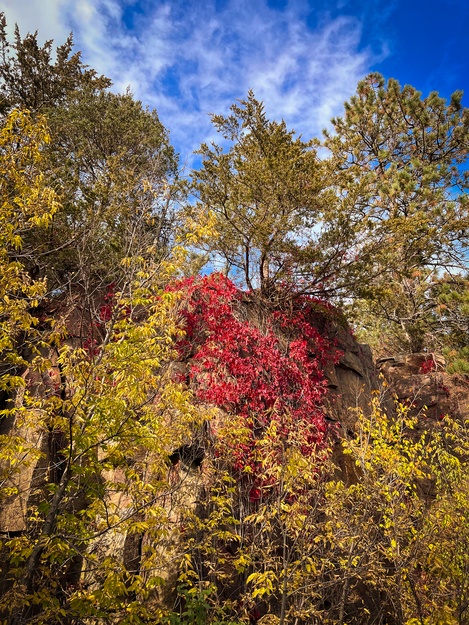
Plus, where else are you going to see a tree that looks like this?
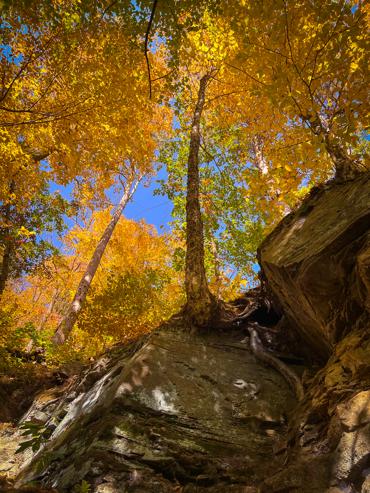
Never seen a view of a tree from literal root level before. But it wouldn’t be the last time on this hike!
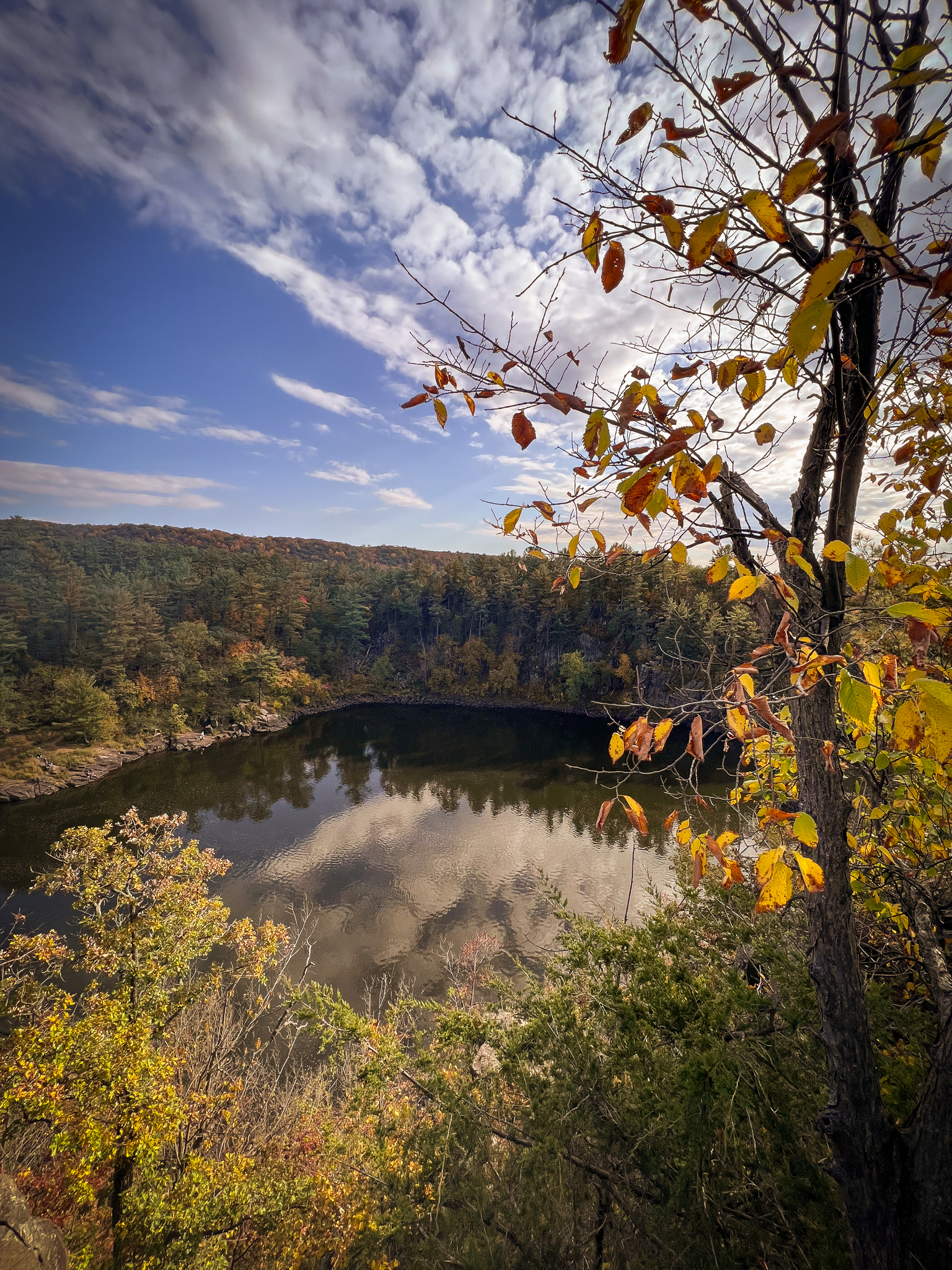
The trail ends where a waterfall once stood, surrounded by a bowl of bluffs and trees.
Called “Curtain Falls,” the water has dried up and only runs in the springtime when the snow and ice begin to melt. I’m not sure that I would enjoy the stairs as much during the springtime, but it might be an adventure I add to the list.
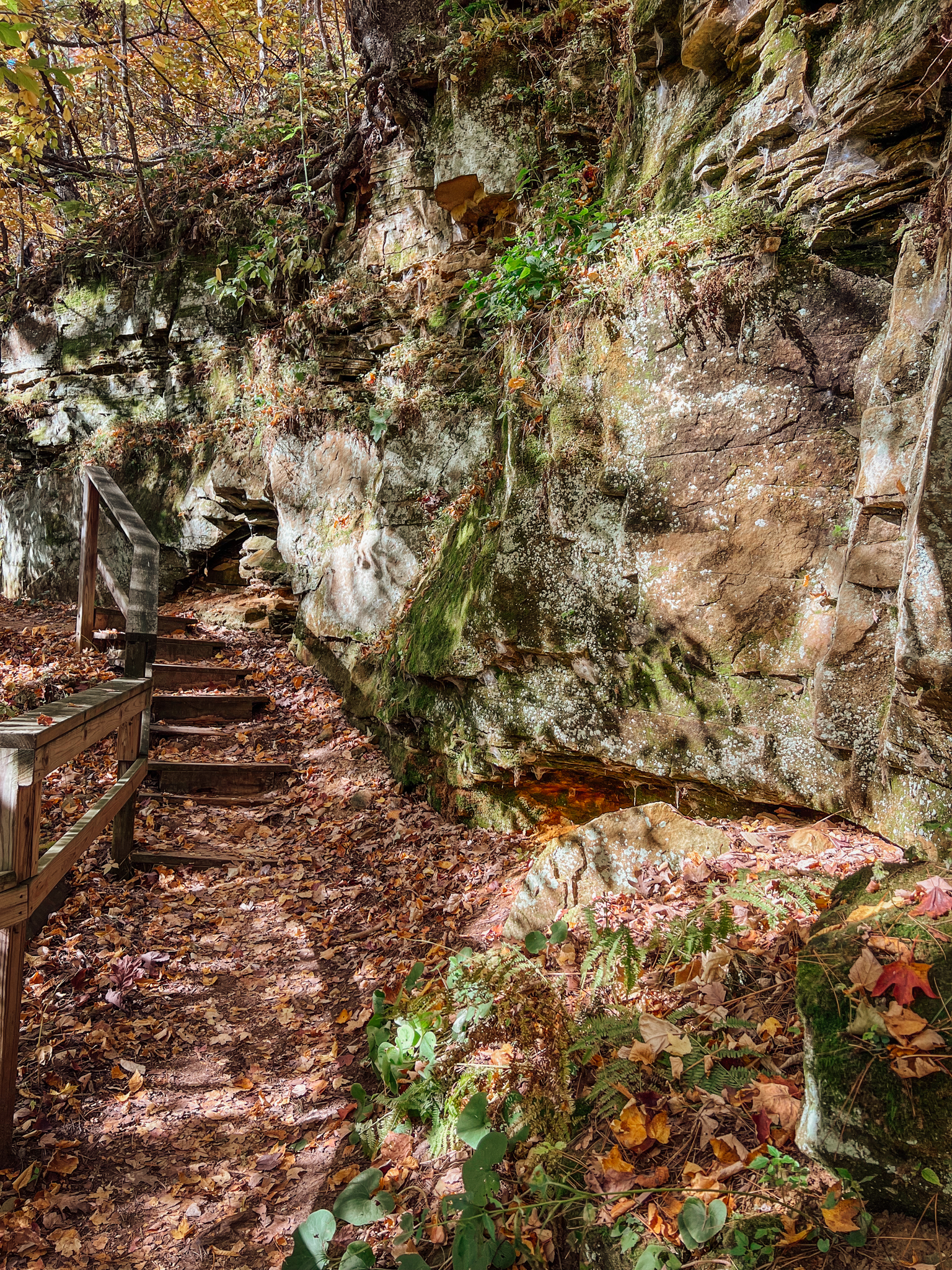
After you check out the waterfall (or imagine the waterfall), you’ll turn around, as the trail ends here and doesn’t quite loop. However, on your way back, stop at the set of super cool stone stairs carved into the bluffs.
And then walk up them.
I was kind of geeking out over these stairs. They’re so cool!! Who made them? They deserve a raise.
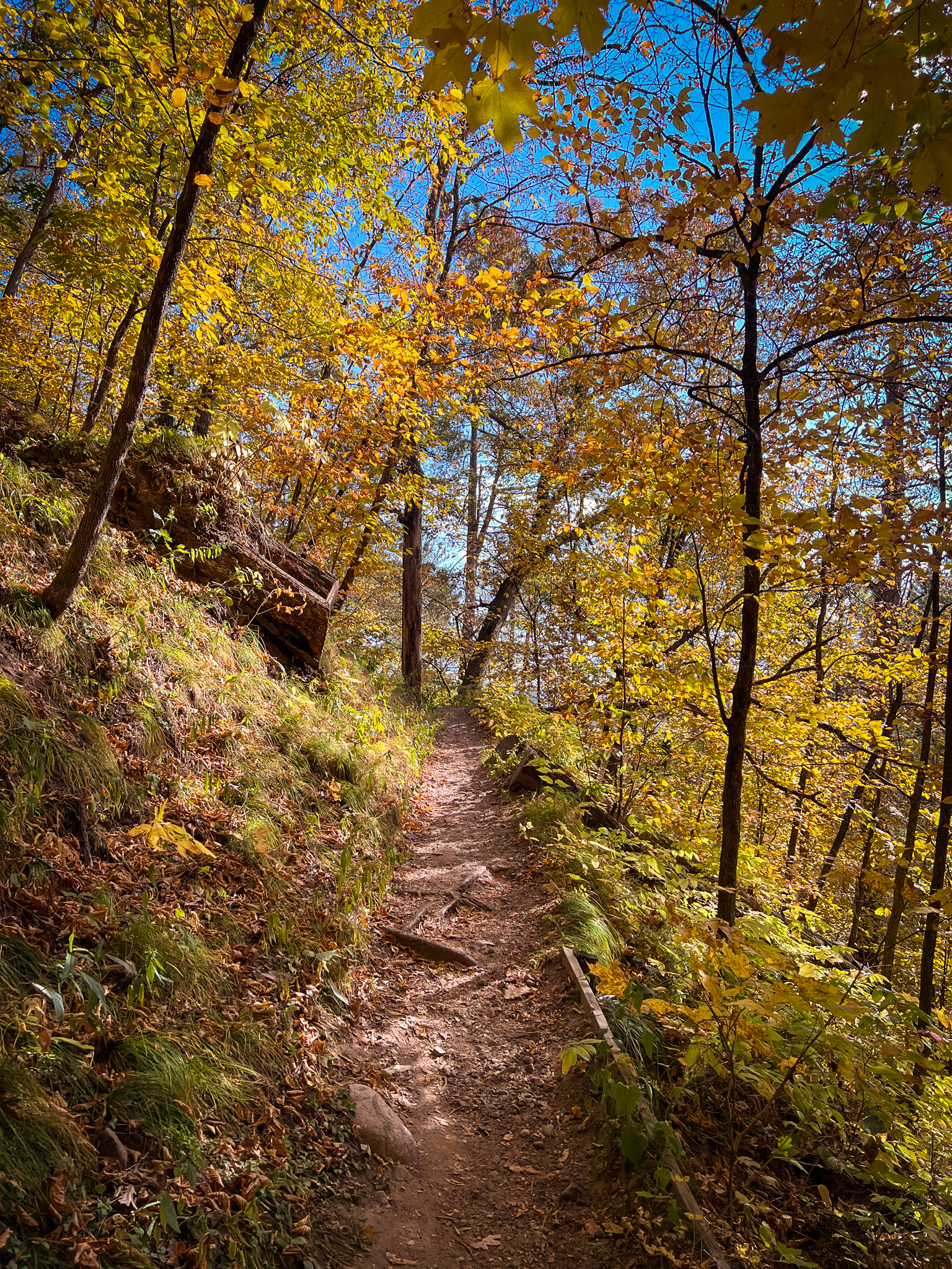
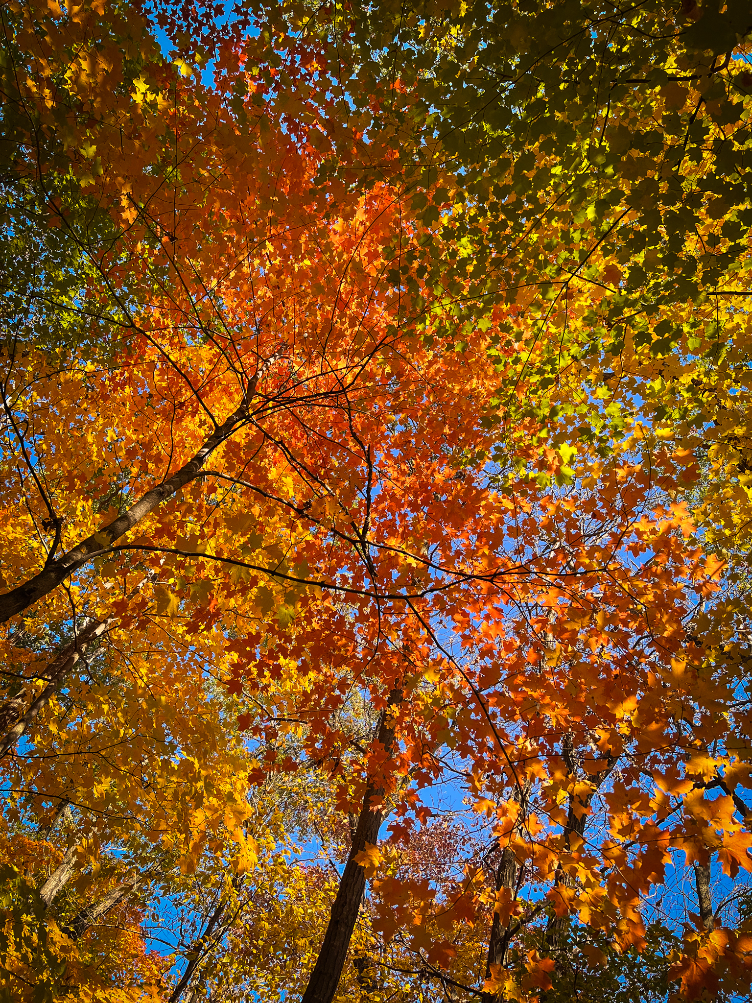
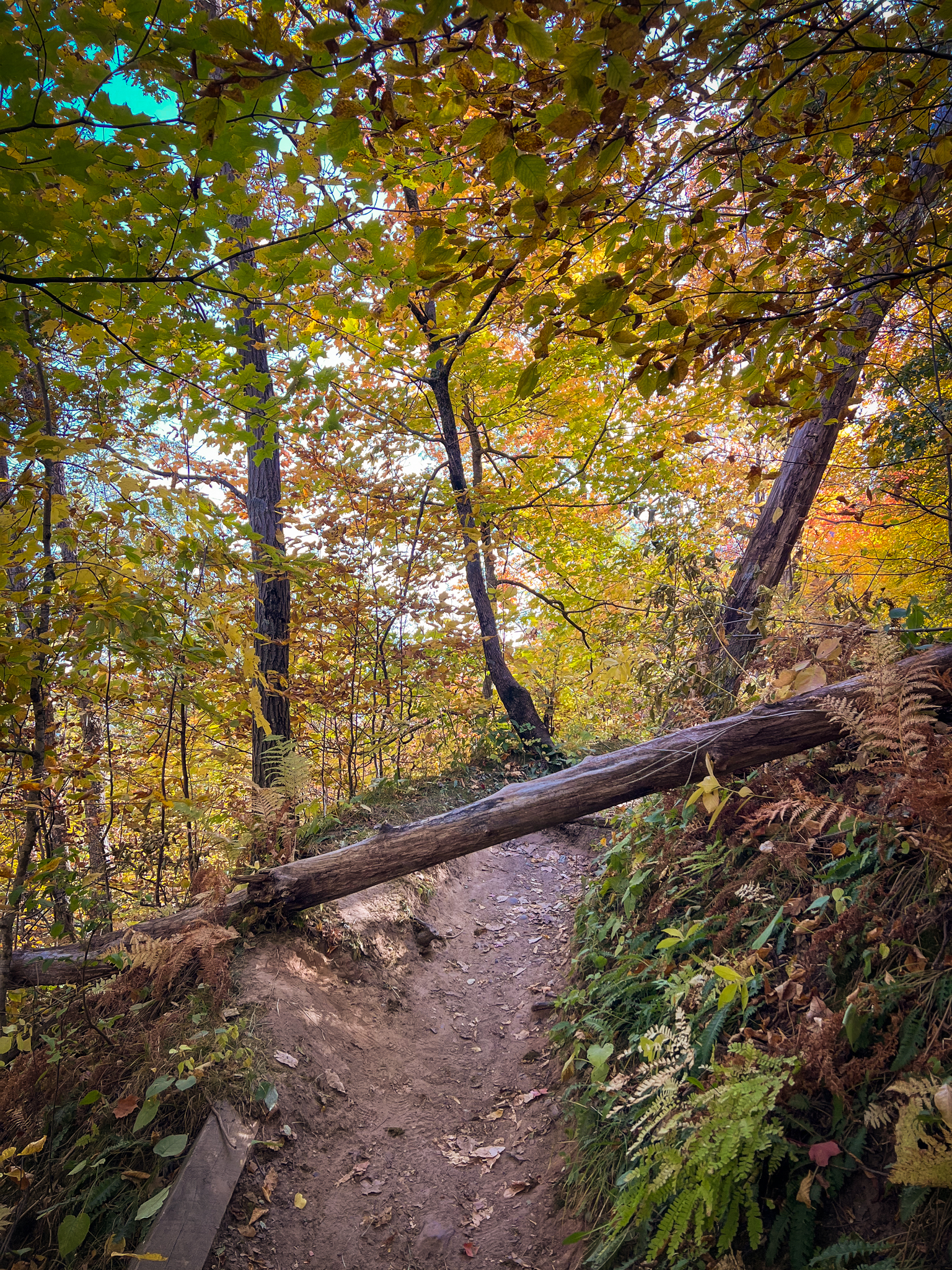
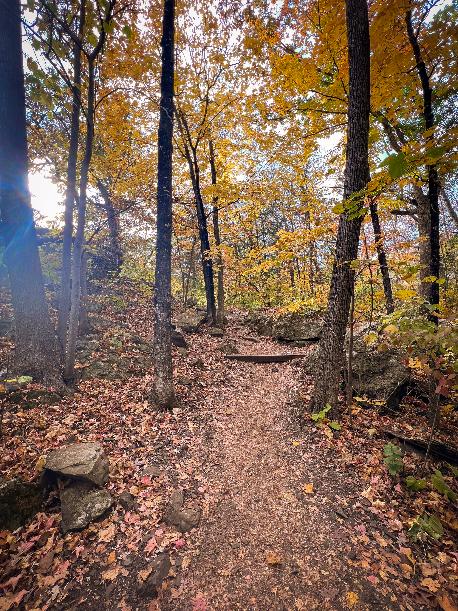
The trail continues to be very slim, but climbs upward through another gorgeous canopy of trees. The leaves were perfect during my hike this fall.
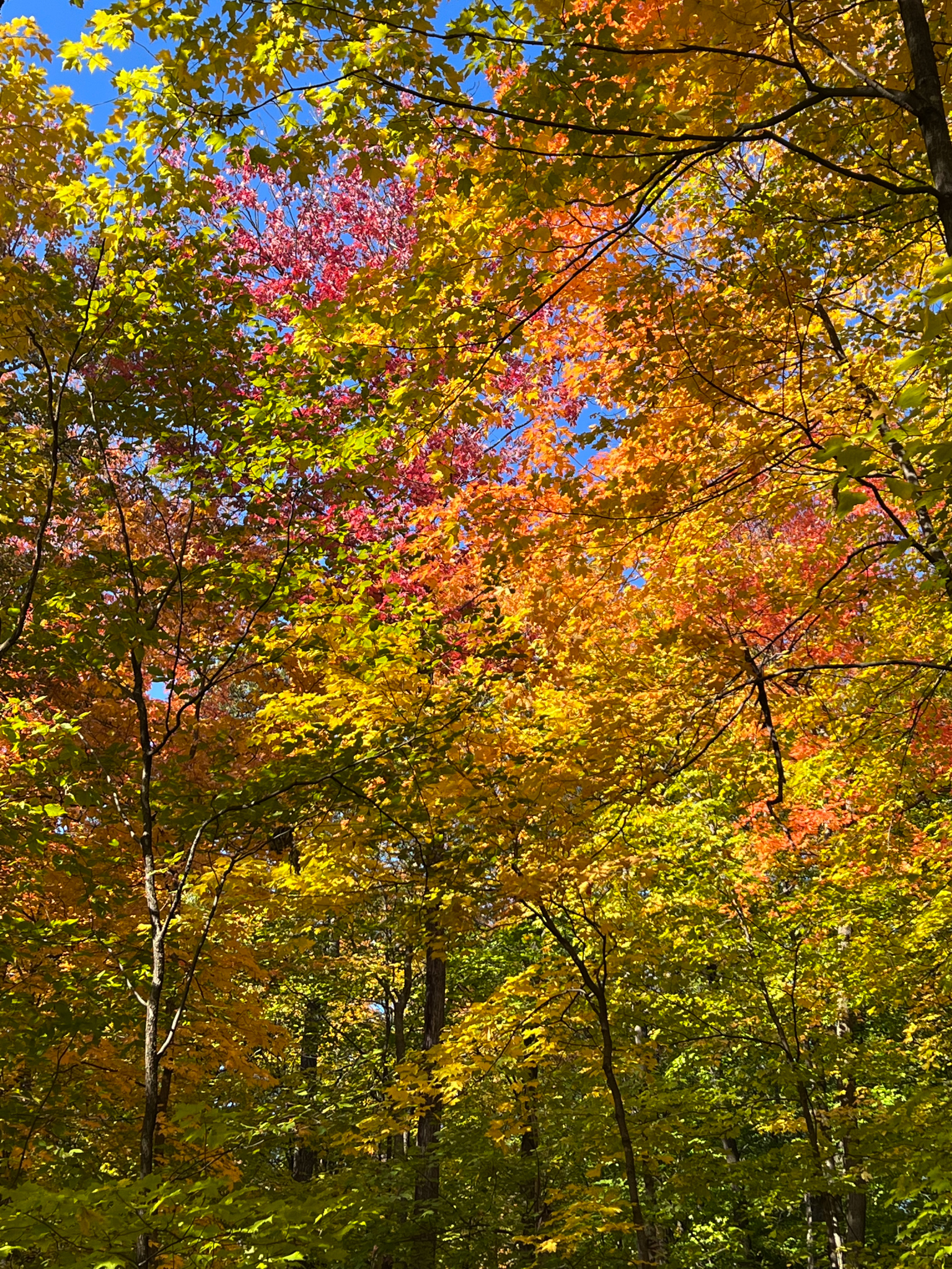
The colors were simply unreal!
Eventually the trail brings you to an overlook, which is a great place to stop if you need to rest a moment. It also has a pretty neat view of the trees at the park.
Just around the bend, I encountered a bit of a roadblock. Poor little guy.
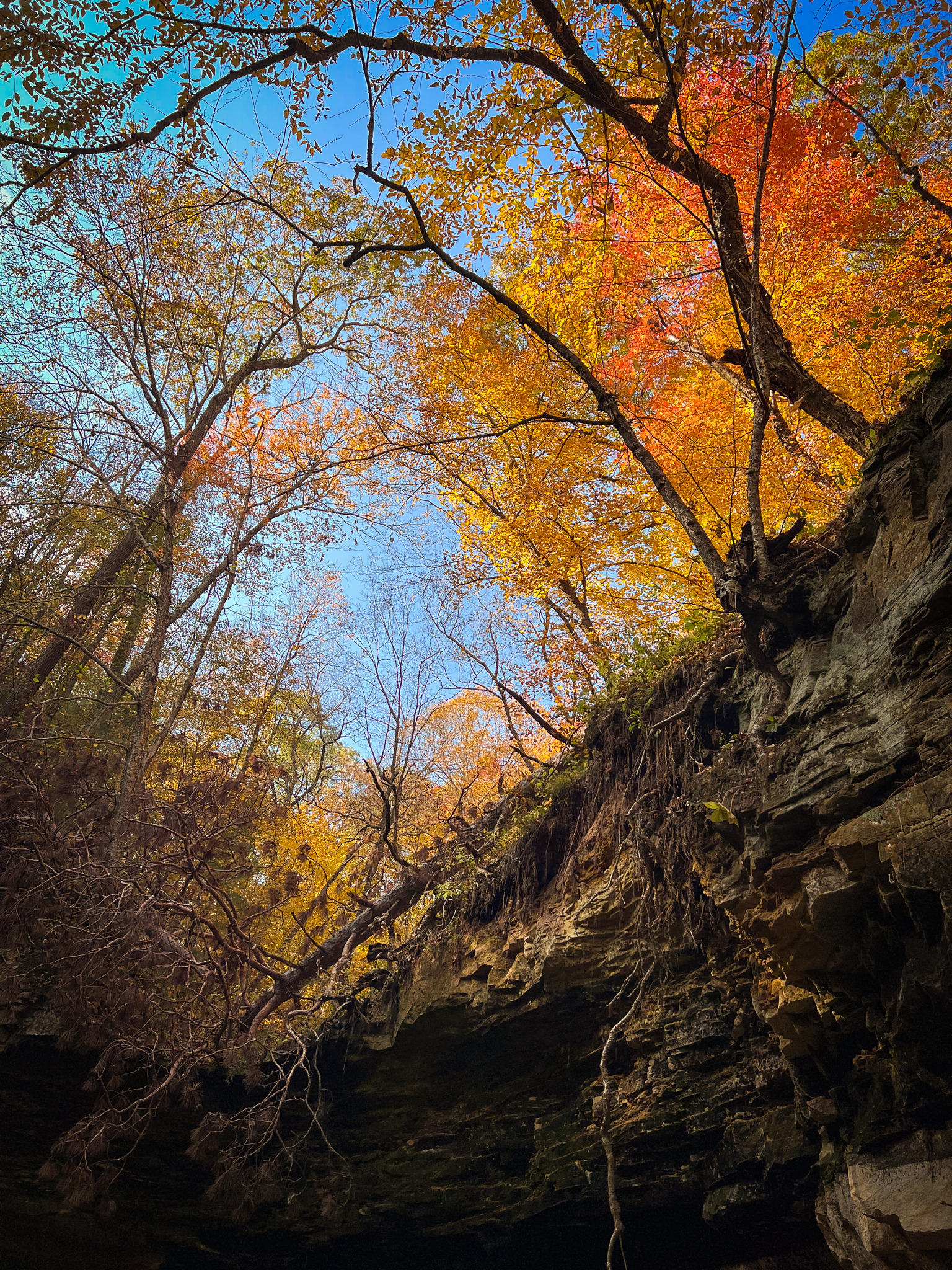
From here, the trail continues to wind across the sides of the bluffs, giving you sprawling views of the valleys between each hill.
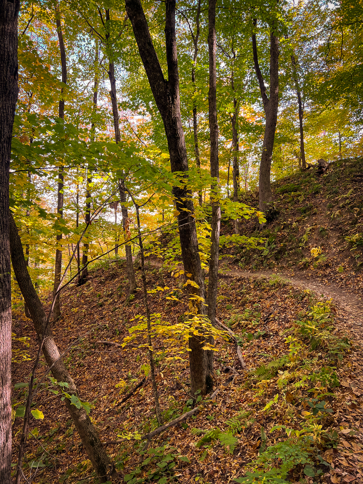
I couldn’t get enough of the views – the fall trees were lovely, but the perspective of being both above and below the trees was super cool.
Eventually, the trail declines and you land in the valley-like section of land between the bluffs. Somewhere nearby was the quiet flow of water – I’m guessing there is more of a river along this portion of the path during the springtime when the snow is melting.
Too soon, the trail will be over. You’ll have the option of heading back where you came from, or you can set your sights on Railroad Trail, which you will very excitedly do because you’ll be so hyped about the awesome trail you just hiked.
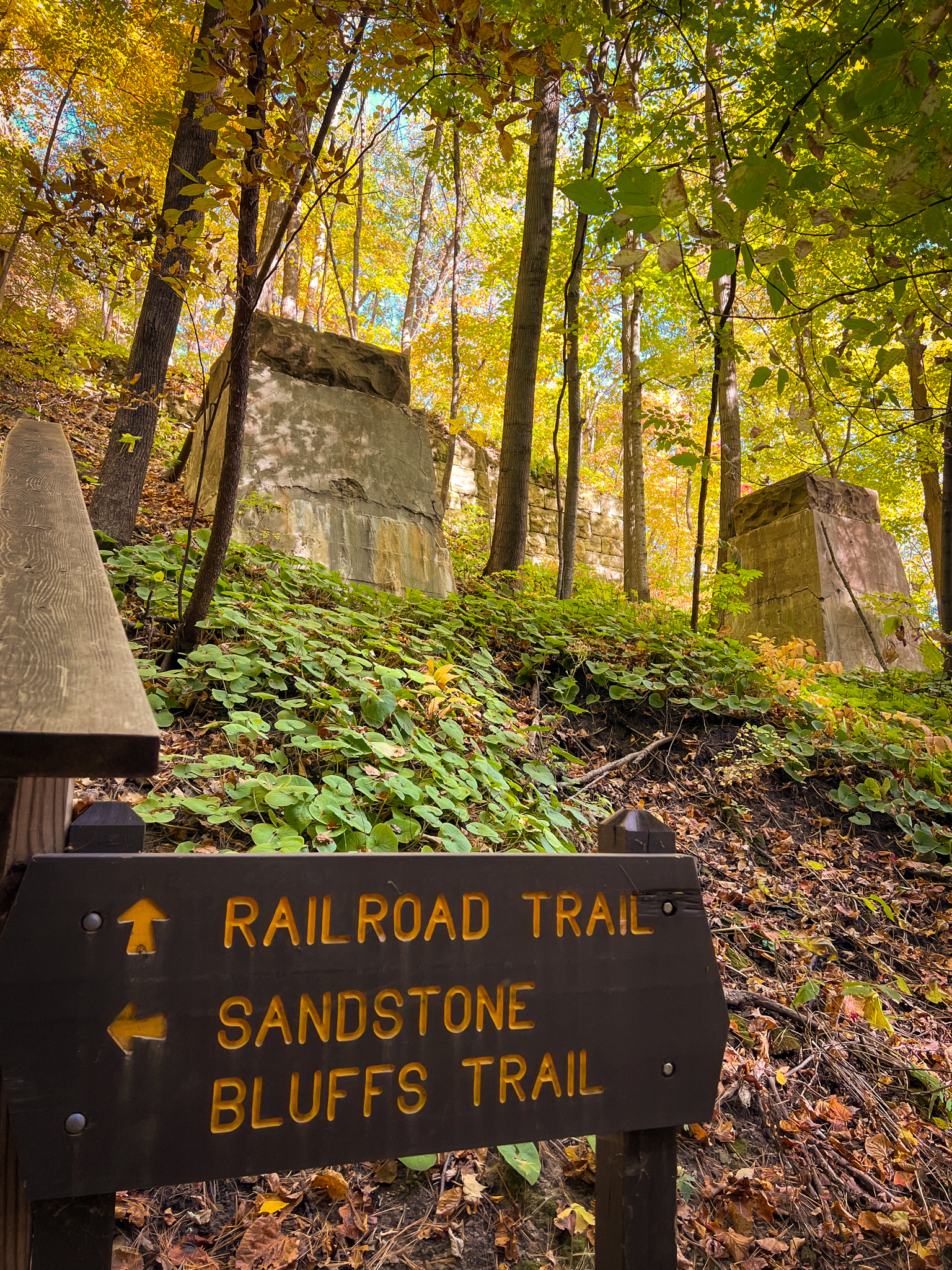
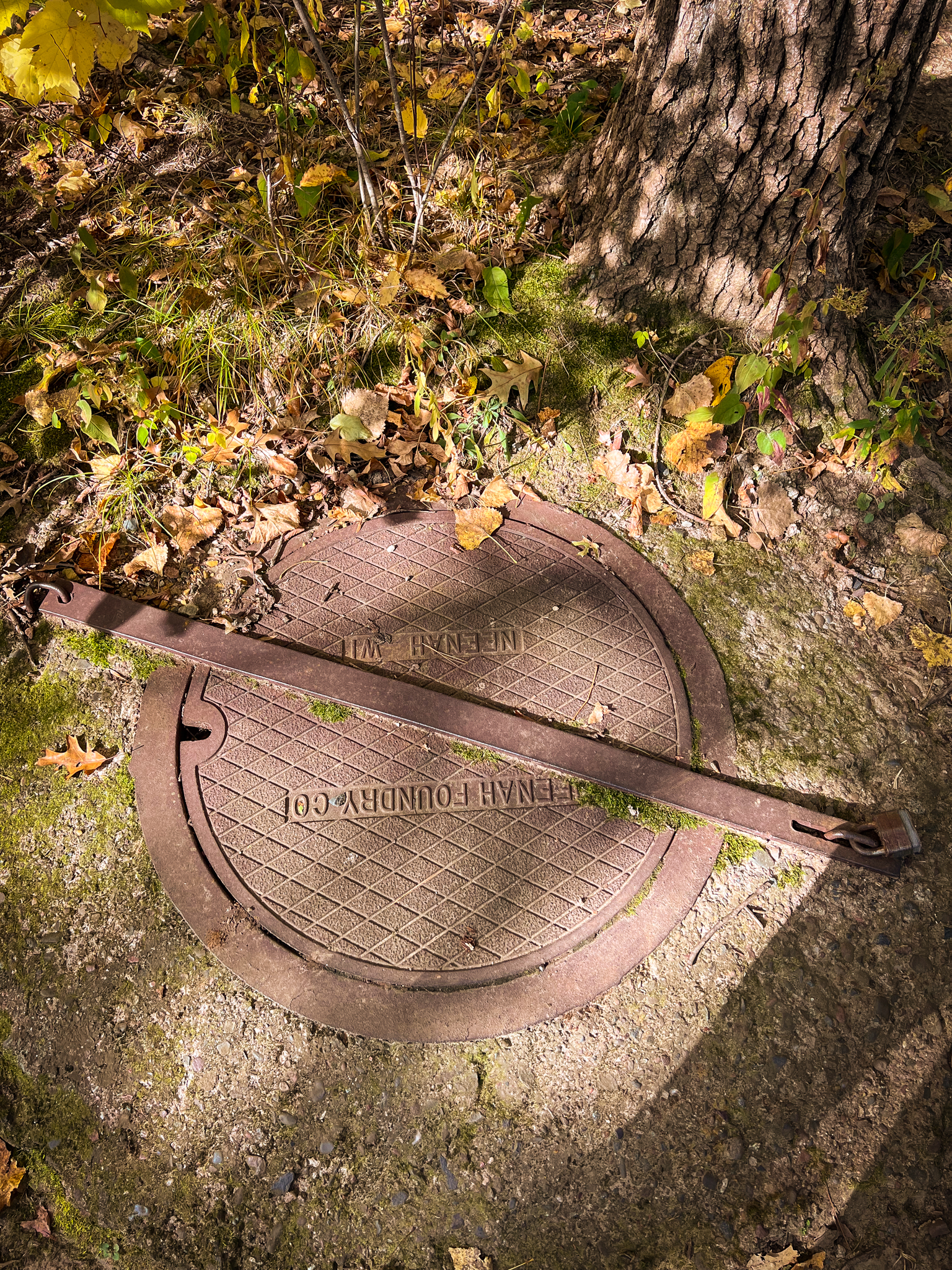
This trail follows the former route of the Northern Pacific Railroad. You’ll see the columns from the old railroad bridges on either side of this intersection. There will be other relics of train days come and gone alone the trail, too.
I hate to break it to you, but you’ll have to take many stairs to get there.
What’s new, honestly?
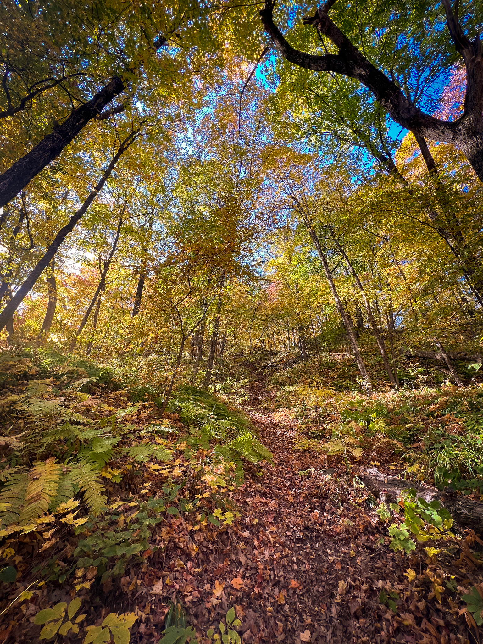
Once you reach the top, you’ll walk along the bluffs for a short distance, before getting to more of a wooded area, which again, is lovely in the fall.
Railroad Trail is 1.5 miles, and it will take you from one end of the park to the other, where the main entrance is. You can either circle back on Railroad Trail to get back to your car, or you can take the River Trail, which is clearly what you’ll do, but we’ll get to that later.
The 1.5 mile hike is extremely flat from this point out, but there are cool remnants from the past, beautiful sets of trees, and the occasionally rocky, bluff-like area.
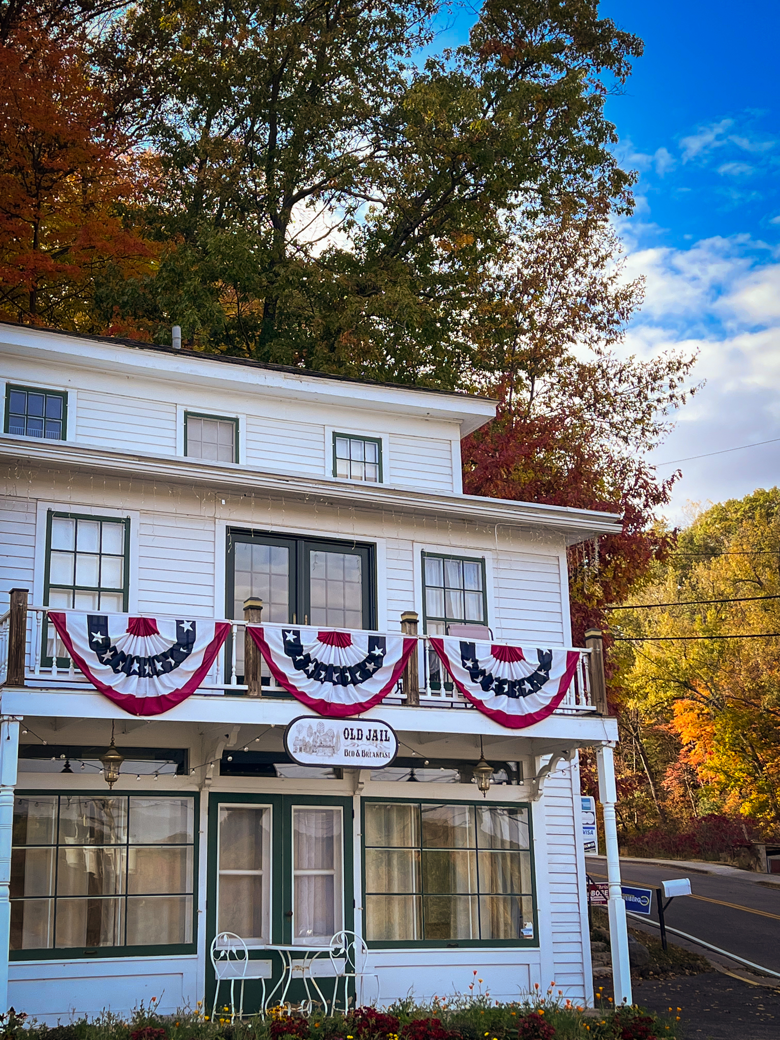
At the end of the trail, you’ll emerge from the woods into town in Taylor’s Falls, where you’ll see many cute, preserved buildings, including this old jailhouse that’s now an inn.
At this point, you can turn around and experience the same trail again, orrrrrr you could catch some sick views of the river. I would highly recommend the second option.
To do so, you’ll walk down the sidewalk out of the trail, cross the street and walk past the gas station, where there is a tunnel below the road that allows you to safely cross the street over to the main park entrance. Walk into the park and into the main trail, and immediately on the right, just before the maps and informational signs, is – you guessed it – a set of stairs. Directional signage will point you to the River Trail.
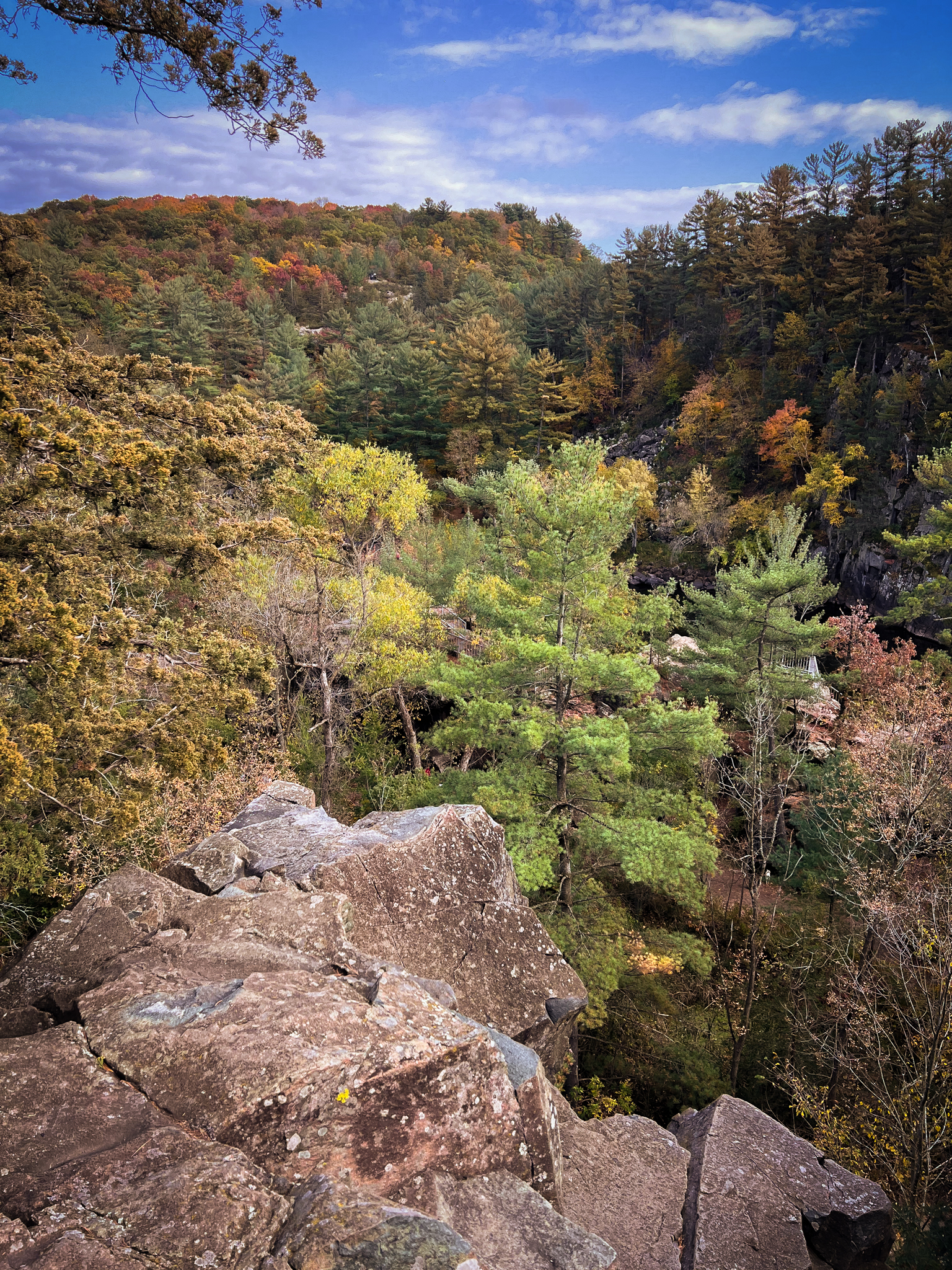
The trail is beautiful, and there are some cool bluffs and rocks along the way.
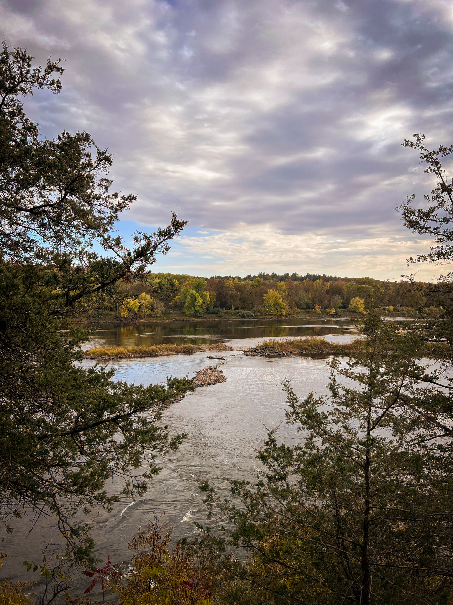
The real gem is in the name, though: the river.
Just wait, though, it gets better and better.
Along the middle section of the route, there will be many overlooks for you to take in views of the river and the bluffs on the opposite side of the water.
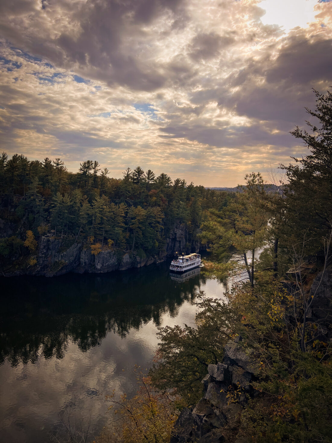
And if you’re really lucky, the sky will be just perfect and the water will be perfectly still until the paddlewheel riverboat glides through.
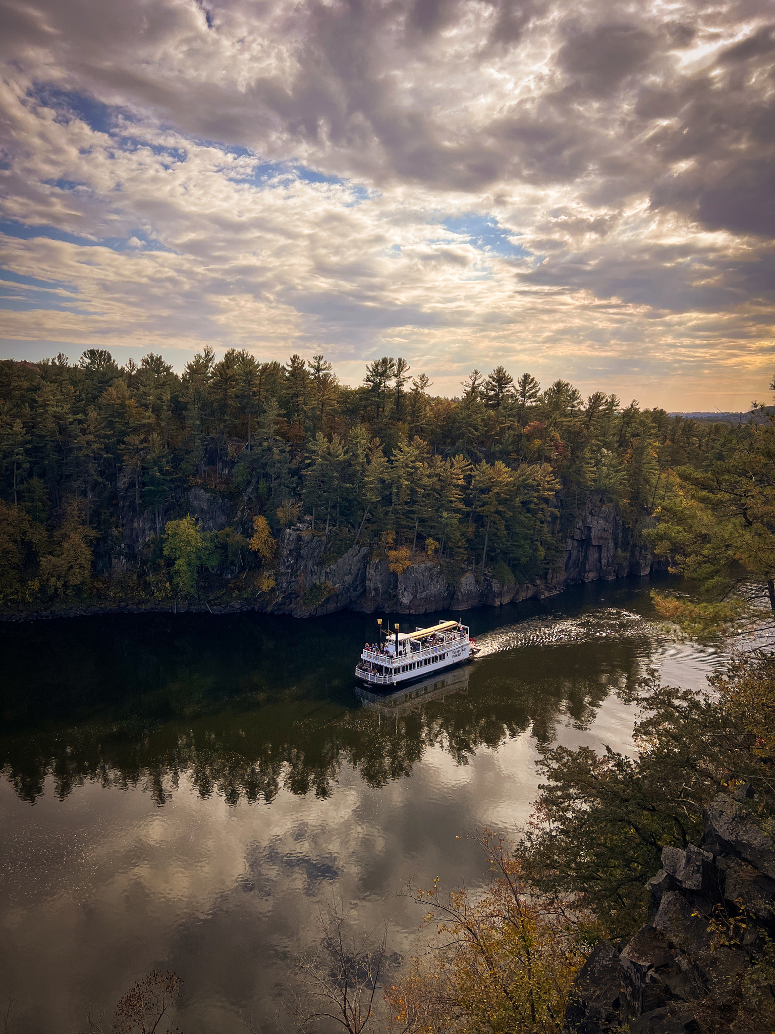
I stood at the top of the bluffs and watched the boat flow past me, waving like an idiot at the passengers – none of whom waved back at me, but then I noticed that the hikers on the other side of the bluff were waving at me, so I felt redeemed by my fellow explorers.
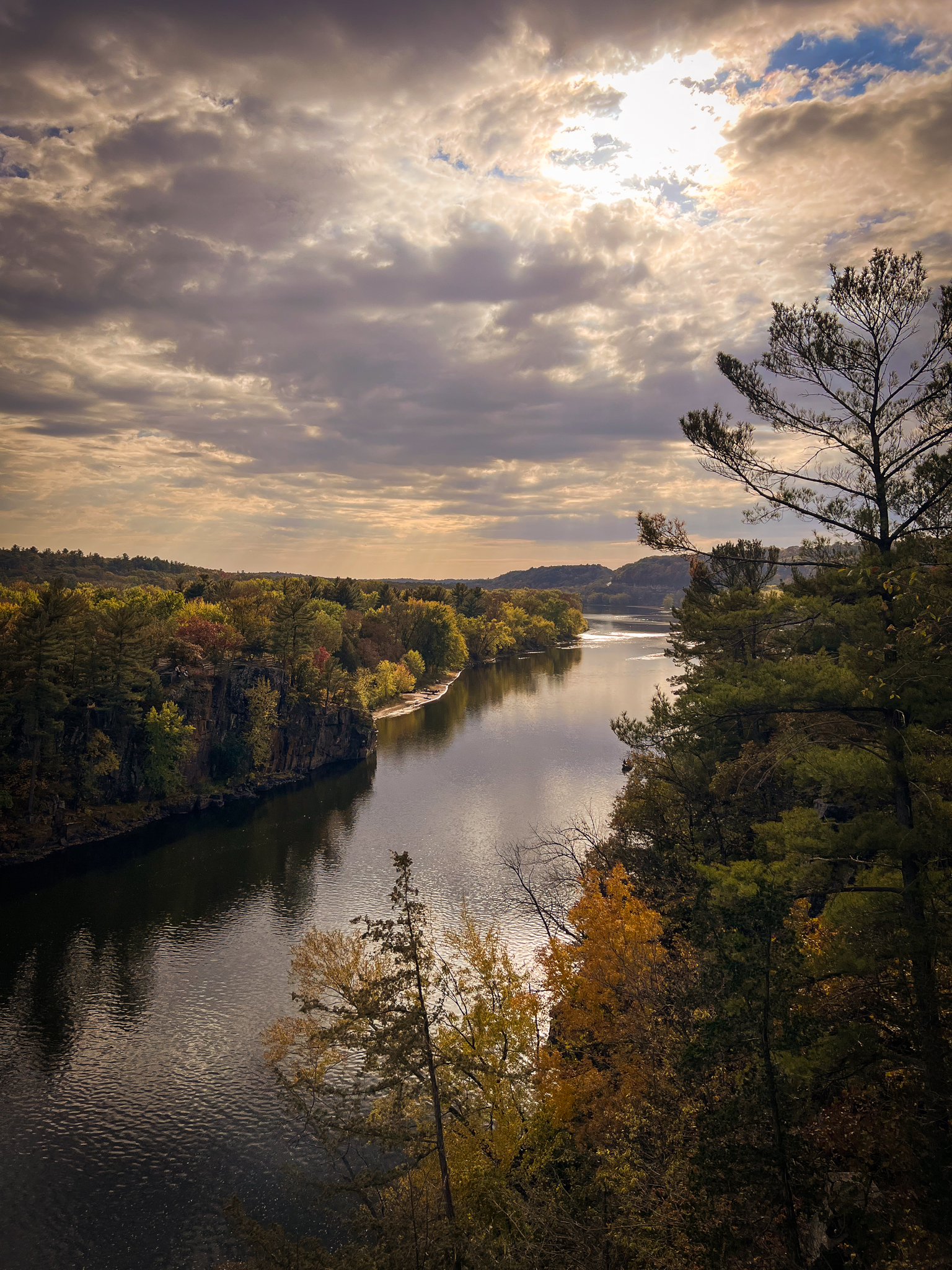
Okay, one more photo of that glorious sky and river and bluffs and leaves and everything.
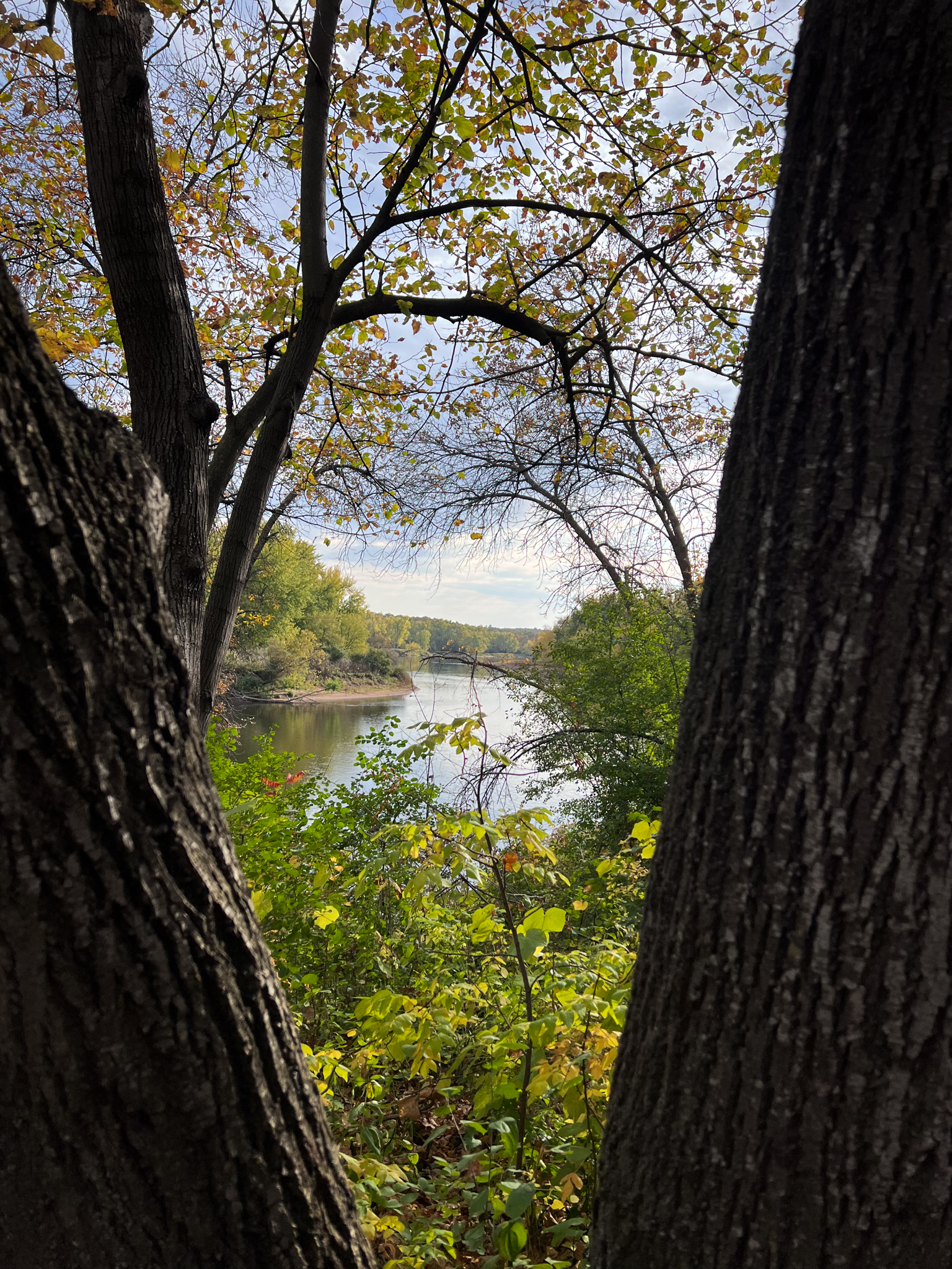
Shortly after the overlooks, the trail once again heads into the woods, where it remains for the rest of its entirety.
You’ll still catch glimpses of the river as you hike, but you’ll be more in the woods and further away from the highway.
And just a short 1.5 miles later, you’ll be right back at the parking lot, hopefully with some lungs that are a little more clear, legs that are just a bit sore, a smile on your face, and a camera roll full of beautiful photos.
Thanks for joining today’s hike! Stay tuned for more adventures!
Let’s Connect: